Category:Mallerstang
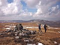
English: Mallerstang is a civil parish in the extreme east of Cumbria - and, geographically, a dale at the head of the upper Eden Valley. Originally part of Westmorland, it lies about 10 km south of the nearest town, Kirkby Stephen. Its eastern edge, at Aisgill, borders on North Yorkshire and the Yorkshire Dales National Park.
civil parish in Cumbria, England, UK  | |||||
| Upload media | |||||
| Instance of | |||||
|---|---|---|---|---|---|
| Located in protected area | |||||
| Location | Eden, Cumbria, North West England, England | ||||
| Area |
| ||||
 | |||||
Subcategories
This category has the following 8 subcategories, out of 8 total.
A
- Ais Gill Viaduct (12 F)
B
- Birkett Tunnel (3 F)
H
- Hell Gill Bridge (3 F)
- Hellgill Force (6 F)
O
P
- Pendragon Castle (56 F)
Media in category "Mallerstang"
The following 200 files are in this category, out of 669 total.
(previous page) (next page)-
 'Gate House', beside B6259 - geograph.org.uk - 4277411.jpg 1,024 × 683; 192 KB
-
 'The Old Stables', Daisy Farm - geograph.org.uk - 4277079.jpg 1,024 × 683; 217 KB
-
 'Water Cut' and Mallerstang Edge - geograph.org.uk - 3409422.jpg 800 × 600; 168 KB
-
 40117 near Ais Gill - geograph.org.uk - 4594516.jpg 1,024 × 768; 270 KB
-
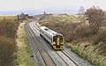
 60096 approaching Ais Gill - February 2018 - geograph.org.uk - 5672019.jpg 1,250 × 887; 1.19 MB
-
 A good path towards High Dolphinsty - geograph.org.uk - 1271300.jpg 640 × 426; 82 KB
-

-
 A heap of rusting cars at Elmgill - geograph.org.uk - 2599363.jpg 640 × 480; 92 KB
-

-
 A tributary of the River Eden - geograph.org.uk - 1271909.jpg 640 × 426; 154 KB
-
 Above Eden Springs - geograph.org.uk - 2137065.jpg 2,560 × 1,920; 1.15 MB
-
 Above Gale Sike - geograph.org.uk - 1583273.jpg 640 × 480; 61 KB
-
 Above High Band - geograph.org.uk - 2137090.jpg 2,560 × 1,920; 750 KB
-
 Access track and footpath to the B6265 road - geograph.org.uk - 2021601.jpg 2,048 × 1,536; 1.28 MB
-
 Ais Gill - geograph.org.uk - 1271637.jpg 640 × 426; 88 KB
-
 Ais Gill - geograph.org.uk - 2015682.jpg 640 × 480; 92 KB
-
 Ais Gill - geograph.org.uk - 5083751.jpg 1,600 × 1,200; 560 KB
-
 Ais Gill Moor, northward at summit on B6259 road, 1991 - geograph.org.uk - 4324851.jpg 2,326 × 1,467; 3.37 MB
-
 Ais Gill Moor, southward at summit on B6259, 1991 - geograph.org.uk - 4324862.jpg 2,303 × 1,373; 3.81 MB
-
 Ais Gill Summit - geograph.org.uk - 4145956.jpg 5,472 × 3,648; 2.2 MB
-
 Ais Gill Summit - geograph.org.uk - 601599.jpg 640 × 399; 84 KB
-
 Ais Gill valley - geograph.org.uk - 5180442.jpg 1,600 × 1,278; 332 KB
-
 Aisgill Bridge (B6259) - geograph.org.uk - 3942800.jpg 1,024 × 768; 141 KB
-
 Aisgill Farm - geograph.org.uk - 2035630.jpg 640 × 480; 84 KB
-
 Aisgill Farm from the railway - geograph.org.uk - 5182747.jpg 1,600 × 1,066; 756 KB
-
 Aisgill Farm, Mallerstang - geograph.org.uk - 1262831.jpg 640 × 480; 64 KB
-
 Aisgill Moor Cottages - geograph.org.uk - 2035615.jpg 1,280 × 960; 234 KB
-
 Aisgill Moor Cottages - geograph.org.uk - 2340325.jpg 1,024 × 768; 107 KB
-
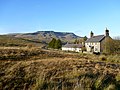 Aisgill Moor Cottages and Wild Boar Fell - geograph.org.uk - 2165469.jpg 3,840 × 2,880; 1.77 MB
-
 Angerholme and Angerholme Gill - geograph.org.uk - 3942774.jpg 1,024 × 768; 128 KB
-
 Angerholme from B6259 south - geograph.org.uk - 2960454.jpg 640 × 476; 100 KB
-
 Angerholme from the north-west - geograph.org.uk - 3942770.jpg 1,024 × 768; 196 KB
-
 Angerholme's setting in Mallerstang - geograph.org.uk - 3442388.jpg 3,872 × 2,592; 4.46 MB
-
 Angrholm Ford - geograph.org.uk - 5719281.jpg 4,032 × 3,024; 3.46 MB
-
 Appleby Manor Hotel - geograph.org.uk - 831403.jpg 640 × 480; 111 KB
-
 Approaching Lady's Pillar, Hugh Seat - geograph.org.uk - 2140553.jpg 640 × 424; 55 KB
-
 Archy Styrigg - geograph.org.uk - 3410801.jpg 800 × 600; 148 KB
-

-
 Ascent path, Swarth Fell - geograph.org.uk - 2164792.jpg 4,320 × 3,240; 5.7 MB
-
 At Aisgill, looking towards Wild Boar Fell - geograph.org.uk - 6057798.jpg 1,600 × 1,200; 375 KB
-
 Aubretia on Pendragon Castle - geograph.org.uk - 3454692.jpg 800 × 600; 173 KB
-
 Autumnal railway high in the Dales - geograph.org.uk - 3220904.jpg 1,200 × 803; 400 KB
-
 Avalanche debris below Hangingstone Scar - geograph.org.uk - 3411541.jpg 800 × 600; 192 KB
-
 B6259 at Carr Bridge - geograph.org.uk - 4276705.jpg 1,024 × 683; 250 KB
-
 B6259 at Elmgill entrance - geograph.org.uk - 2960448.jpg 640 × 473; 115 KB
-

-
 B6259 south approaching Angerholme - geograph.org.uk - 2960450.jpg 640 × 501; 104 KB
-
 B6259 south entering Outhgill - geograph.org.uk - 2960421.jpg 640 × 460; 69 KB
-
 B6259 south of The Thrang - geograph.org.uk - 2960439.jpg 640 × 440; 86 KB
-
 Barn and bridge by the Eden - geograph.org.uk - 2340409.jpg 1,024 × 768; 145 KB
-

-
 Barn and valley of Smithy Gill - geograph.org.uk - 5180438.jpg 1,600 × 800; 442 KB
-
 Barn at Aisgill Bridge - geograph.org.uk - 4055875.jpg 3,648 × 2,736; 4.22 MB
-
 Barn at Hazelrigg - geograph.org.uk - 6223372.jpg 1,280 × 1,280; 831 KB
-
 Barn beside B6259 at Outhgill - geograph.org.uk - 4195213.jpg 1,024 × 683; 233 KB
-
 Barn by Cumpston Hill Farm - geograph.org.uk - 3440760.jpg 3,872 × 2,592; 5.08 MB
-
 Barn by the River Eden - geograph.org.uk - 2177517.jpg 1,024 × 768; 271 KB
-

-
 Barn near Angerholme - geograph.org.uk - 2232028.jpg 640 × 480; 80 KB
-
 Barn near Stirk House - geograph.org.uk - 3440770.jpg 3,872 × 2,592; 5.38 MB
-
 Barn off the B6259 below High Bank Scar - geograph.org.uk - 4194931.jpg 1,024 × 683; 215 KB
-
 Barns below High Bank - geograph.org.uk - 3442450.jpg 3,872 × 2,592; 4.97 MB
-
 Below Great Bell - geograph.org.uk - 2177556.jpg 1,024 × 768; 131 KB
-
 Bench Mark, St Marys Church - geograph.org.uk - 1817113.jpg 640 × 480; 189 KB
-
 Benchmark on 'Gate House' - geograph.org.uk - 4277407.jpg 1,024 × 648; 294 KB
-
 Benchmark on barn beside B6259 - geograph.org.uk - 4276673.jpg 683 × 1,024; 251 KB
-
 Benchmark on barn beside B6259 at Outhgill - geograph.org.uk - 4194976.jpg 1,024 × 683; 336 KB
-
 Benchmark on barn beside B6259 by Smithy Gill - geograph.org.uk - 3771618.jpg 683 × 1,024; 238 KB
-
 Benchmark on barn near Cooper Hill - geograph.org.uk - 4194910.jpg 683 × 1,024; 315 KB
-
 Benchmark on bridge for B6259 over Ais Gill - geograph.org.uk - 4194758.jpg 1,024 × 683; 226 KB
-
 Benchmark on bridge over Southwaite Gill - geograph.org.uk - 4195331.jpg 1,024 × 683; 278 KB
-
 Benchmark on Carr Bridge - geograph.org.uk - 4276693.jpg 683 × 1,024; 273 KB
-
 Benchmark on culvert near Ais Gill - geograph.org.uk - 4194714.jpg 1,024 × 615; 261 KB
-
 Benchmark on Daisy Farm - geograph.org.uk - 4276986.jpg 683 × 1,024; 309 KB
-
 Benchmark on gatepost beside track to Deep Gill - geograph.org.uk - 4194949.jpg 683 × 1,024; 282 KB
-
 Benchmark on Moorriggs entrance gatepost - geograph.org.uk - 4277420.jpg 652 × 1,024; 206 KB
-
 Benchmark on old stables at Daisy Farm - geograph.org.uk - 4277039.jpg 683 × 1,024; 313 KB
-
 Benchmark on rock in Smithy Gill - geograph.org.uk - 5489103.jpg 1,024 × 683; 270 KB
-
 Benchmark on St Mary's Church - geograph.org.uk - 4276954.jpg 683 × 1,024; 346 KB
-

-
 Bend in the fence line on Wild Boar Fell - geograph.org.uk - 3444768.jpg 3,872 × 2,592; 4.37 MB
-
 Bent Side and Aisgill - geograph.org.uk - 2166725.jpg 640 × 480; 84 KB
-
 Between Wild Boar and Swarth Fells - geograph.org.uk - 2036152.jpg 640 × 480; 85 KB
-
 Big Hills in the Clag - geograph.org.uk - 1397520.jpg 640 × 209; 29 KB
-
 Birkdale Beck - geograph.org.uk - 561958.jpg 640 × 480; 99 KB
-
 Birkett Common - geograph.org.uk - 1671301.jpg 640 × 480; 54 KB
-
 Birkett Common - geograph.org.uk - 1981934.jpg 640 × 427; 297 KB
-
 Birkett Common - geograph.org.uk - 3873690.jpg 640 × 425; 192 KB
-
 Birkett Common - geograph.org.uk - 3873697.jpg 640 × 425; 163 KB
-
 Birkett Common - geograph.org.uk - 3873727.jpg 640 × 425; 202 KB
-
 Birkett Common - geograph.org.uk - 4055822.jpg 3,648 × 2,736; 3.95 MB
-
 Birkett Common - geograph.org.uk - 5847395.jpg 2,048 × 1,536; 1.16 MB
-
 Black Fell Moss - geograph.org.uk - 2163242.jpg 640 × 480; 114 KB
-
 Blackbed Scar - geograph.org.uk - 1271551.jpg 640 × 426; 110 KB
-
 Blackbed Scar, Wild Boar Fell - geograph.org.uk - 2393646.jpg 640 × 425; 306 KB
-
 Blades Farm - geograph.org.uk - 1369729.jpg 640 × 480; 112 KB
-
 Bog on High Seat - geograph.org.uk - 1982716.jpg 427 × 640; 262 KB
-
 Boggle Green Ford - geograph.org.uk - 5719283.jpg 4,032 × 3,024; 2.79 MB
-
 Boggle Green with Loven Scar beyond - geograph.org.uk - 1271933.jpg 640 × 426; 108 KB
-
 Boundary stone beside B6259 at Watergate Bottom - geograph.org.uk - 4195364.jpg 1,024 × 683; 266 KB
-

-

-
 Bridge over Deep Gill - geograph.org.uk - 2021593.jpg 2,048 × 1,536; 1.68 MB
-
 Bridge over the River Eden - geograph.org.uk - 1816485.jpg 640 × 480; 156 KB
-
 Bridge taking B6259 over Parrock Gill - geograph.org.uk - 4276748.jpg 1,024 × 683; 269 KB
-
 Bridging the gill - geograph.org.uk - 2342870.jpg 1,024 × 768; 199 KB
-
 Bridleway above Slade Edge - geograph.org.uk - 2165278.jpg 4,320 × 3,240; 5.31 MB
-

-
 Bridleway sign at a Tommy Road bend - geograph.org.uk - 2342755.jpg 1,024 × 768; 163 KB
-
 Bridleway to Elmgill - geograph.org.uk - 1816498.jpg 640 × 480; 141 KB
-
 Bridleway to Hanging Lund - geograph.org.uk - 2165315.jpg 4,320 × 3,240; 5.59 MB
-
 Bridleway to Mallerstang - geograph.org.uk - 1623001.jpg 640 × 425; 254 KB
-
 Broken walls and a ruined barn - geograph.org.uk - 2342902.jpg 1,024 × 768; 112 KB
-
 Brookside - geograph.org.uk - 5719801.jpg 1,600 × 1,076; 345 KB
-
 Byway on Birkett Common - geograph.org.uk - 5781675.jpg 1,600 × 1,200; 592 KB
-
 Byway towards Black Hill Hollow - geograph.org.uk - 5781000.jpg 1,600 × 1,200; 709 KB
-
 Cairn on Fair Hill - geograph.org.uk - 2017184.jpg 640 × 480; 64 KB
-
 Cairn on Gregory Chapel (695m) - geograph.org.uk - 3410809.jpg 800 × 600; 147 KB
-
 Cairn on High Brae - geograph.org.uk - 1982698.jpg 640 × 427; 271 KB
-
 Cairn on High Seat - geograph.org.uk - 3033854.jpg 1,500 × 1,125; 1.34 MB
-
 Cairn on Hugh Seat - geograph.org.uk - 3128278.jpg 1,024 × 683; 219 KB
-
 Cairn on Swarth Fell Pike - geograph.org.uk - 2165174.jpg 3,840 × 2,220; 1.15 MB
-
 Cairn on Swarth Fell Pike - geograph.org.uk - 3445769.jpg 3,872 × 2,592; 4.82 MB
-
 Cairn on Swarth Fell Pike - geograph.org.uk - 3445777.jpg 3,872 × 2,592; 4.71 MB
-
 Cairn on the Nab - geograph.org.uk - 2057376.jpg 3,648 × 2,736; 1.72 MB
-
 Cairn on The Rigg - geograph.org.uk - 2163222.jpg 640 × 480; 61 KB
-
 Cairn on Wild Boar Fell - geograph.org.uk - 2393684.jpg 640 × 425; 245 KB
-
 Cairn, rocks and shelter at Gregory Band - geograph.org.uk - 3034256.jpg 1,500 × 1,125; 1.33 MB
-

-

-

-
 Cairns above High White Scarr - geograph.org.uk - 2057448.jpg 3,648 × 2,736; 1.82 MB
-
 Cairns on Great Bell - geograph.org.uk - 2599929.jpg 640 × 480; 56 KB
-
 Cairns on High white scar. - geograph.org.uk - 3052712.jpg 640 × 569; 79 KB
-

-
 Carr House - geograph.org.uk - 5847385.jpg 2,048 × 1,536; 841 KB
-
 Castle Barn - geograph.org.uk - 1804375.jpg 3,296 × 2,472; 2.57 MB
-
 Castle Bridge - geograph.org.uk - 3969171.jpg 640 × 425; 230 KB
-
 Castle Bridge over the River Eden - geograph.org.uk - 1804370.jpg 2,197 × 1,648; 1.02 MB
-
 Castle ruins - geograph.org.uk - 3338011.jpg 2,048 × 1,536; 1.45 MB
-
 Castlethwaite - geograph.org.uk - 1833798.jpg 3,264 × 2,448; 1.95 MB
-

-
 Convoy of vehicles on byway on Birkett Fell (geograph 6565775).jpg 1,999 × 1,257; 2.42 MB
-
 Cooper Hill Farm - geograph.org.uk - 3442438.jpg 3,872 × 2,592; 3.74 MB
-

-

-
 Cote Gill - geograph.org.uk - 5477984.jpg 1,024 × 768; 586 KB
-
 Cote Gill bridge - geograph.org.uk - 3338137.jpg 2,048 × 1,536; 875 KB
-

-
 Cote Gill stream - geograph.org.uk - 1962280.jpg 640 × 426; 109 KB
-

-
 Cotegill Bridge - geograph.org.uk - 1343528.jpg 640 × 480; 80 KB
-
 Cotegill Bridge - geograph.org.uk - 4055881.jpg 3,648 × 2,736; 4.19 MB
-
 Cotegill Bridge from the other side of the Eden - geograph.org.uk - 3440739.jpg 3,872 × 2,592; 5.18 MB
-
 Cottage at the Thrang on B6259 - geograph.org.uk - 2960437.jpg 640 × 480; 88 KB
-
 Countryside at High Cocklake - geograph.org.uk - 4295553.jpg 2,592 × 1,944; 1.49 MB
-
 Crossing Ais Gill - geograph.org.uk - 5703134.jpg 640 × 451; 94 KB
-

-
 Daisy Farm - geograph.org.uk - 4276995.jpg 1,024 × 683; 173 KB
-
 Dalefoot - geograph.org.uk - 5781678.jpg 1,600 × 1,200; 562 KB
-
 Dalefoot and the River Eden - geograph.org.uk - 1028120.jpg 640 × 480; 69 KB
-
 Dalefoot from B6259 south - geograph.org.uk - 2960416.jpg 640 × 480; 73 KB
-
 Damaged benchmark on Parrock Gill bridge - geograph.org.uk - 4276741.jpg 1,024 × 683; 247 KB
-
 Derelict barn at Cowstead Gill - geograph.org.uk - 5780981.jpg 1,600 × 1,200; 1,010 KB
-
 Descent from Wild Boar Fell - geograph.org.uk - 2164707.jpg 4,320 × 3,240; 5.58 MB
-
 Disused mine working, Long Crag - geograph.org.uk - 2028703.jpg 640 × 480; 119 KB
-
 Dried up tarn on Swarth Fell - geograph.org.uk - 3445721.jpg 3,872 × 2,592; 5.22 MB
-
 Drive to Hazel Gill Farm - geograph.org.uk - 1816500.jpg 640 × 480; 145 KB
-
 Dropping off the edge - geograph.org.uk - 2342766.jpg 1,024 × 768; 112 KB
-
 Drystone wall spans Hazel Gill - geograph.org.uk - 2164237.jpg 4,320 × 3,240; 5.56 MB
-
 Drystone wall, Lock Hill - geograph.org.uk - 3942739.jpg 1,024 × 768; 125 KB
-
 East of Mallerstang Edge - geograph.org.uk - 4349807.jpg 640 × 480; 372 KB
-
 Eden Valley fields - geograph.org.uk - 2340349.jpg 1,024 × 768; 143 KB
-
 Eden valley trees - geograph.org.uk - 2340361.jpg 1,024 × 768; 133 KB
-
 Eden valley woollies - geograph.org.uk - 2165303.jpg 3,200 × 2,700; 1.21 MB
-
 Eden valley, near the Thrang - geograph.org.uk - 2342839.jpg 1,024 × 768; 150 KB
-
 Elmgill Farm, below Mallerstang Edge - geograph.org.uk - 1702176.jpg 1,280 × 812; 414 KB
-
 Elmgill farmhouse - geograph.org.uk - 2342898.jpg 1,024 × 768; 170 KB
-
 Enjoying the sculpture beside the Pennine Bridleway - geograph.org.uk - 5780966.jpg 1,600 × 1,200; 510 KB
-

-
 Entrance to Elmgill - geograph.org.uk - 2177532.jpg 1,024 × 768; 150 KB
-
 Exposed rocks below Swarth Fell - geograph.org.uk - 3445752.jpg 3,872 × 2,592; 4.45 MB
-
 Far Cote Gill and Near Cote Gill - geograph.org.uk - 2177506.jpg 1,024 × 768; 176 KB
-

-
 Far Cote Gill falls - geograph.org.uk - 1962277.jpg 640 × 426; 88 KB
-
 Farm entrance at Angerholme - geograph.org.uk - 4276684.jpg 1,024 × 683; 218 KB
-
 Farm track and footpath above Sycamore Tree Farm - geograph.org.uk - 3942458.jpg 1,024 × 768; 116 KB
-
 Farm track to Elmgill - geograph.org.uk - 1754218.jpg 2,592 × 1,944; 1.56 MB
-
 Fell above High Cocklade - geograph.org.uk - 3879954.jpg 1,024 × 768; 167 KB
-
 Fell ponies on Angerholme Wold - geograph.org.uk - 2036143.jpg 640 × 480; 85 KB
-
 Fellside at High Brae - geograph.org.uk - 1223290.jpg 640 × 480; 91 KB
-
 Fence line crossing Swarth Fell Pike - geograph.org.uk - 4168891.jpg 1,500 × 885; 1.3 MB
-
 Fence near Hugh Seat - geograph.org.uk - 3128268.jpg 1,024 × 683; 176 KB
-
 Fence, Hugh Seat - geograph.org.uk - 2137077.jpg 2,560 × 1,920; 1.18 MB
-
 Field barn near Dry Gill - geograph.org.uk - 3942422.jpg 1,024 × 768; 106 KB
-
 Field barn on the path to Castlethwaite - geograph.org.uk - 2340371.jpg 1,024 × 768; 111 KB
-
 Fields giving way to fells - geograph.org.uk - 2343338.jpg 1,024 × 768; 135 KB
-
 Fields Near Shoregill - geograph.org.uk - 1981915.jpg 640 × 427; 268 KB
-

-
 Flue Scarth Nick - geograph.org.uk - 1566923.jpg 640 × 480; 56 KB


_-_geograph.org.uk_-_3942800.jpg)


_(9862901825).jpg)


_-_geograph.org.uk_-_3410809.jpg)


_-_geograph.org.uk_-_4600187.jpg)


.jpg)


