Category:Manistee, Michigan
English: City of Manistee — the county seat of Manistee County, in northeastern Lower Michigan.
- Located on the eastern shore of Lake Michigan.
city in Michigan, United States   | |||||
| Upload media | |||||
| Instance of | |||||
|---|---|---|---|---|---|
| Location | Manistee County, Michigan | ||||
| Head of government |
| ||||
| Inception |
| ||||
| Population |
| ||||
| Area |
| ||||
| Elevation above sea level |
| ||||
| Different from | |||||
| official website | |||||
 | |||||
Subcategories
This category has the following 5 subcategories, out of 5 total.
Media in category "Manistee, Michigan"
The following 25 files are in this category, out of 25 total.
-

-
 1911-US-PostalCard-McKinleyRed.jpg 1,682 × 998; 283 KB
-
 5th Avenue Beach, Manistee, Michigan.jpg 2,592 × 1,944; 366 KB
-
 Algorail at Manistee - IMO 6805531 (5105819379).jpg 4,320 × 3,240; 3.78 MB
-
 Algorail at Manistee - IMO 6805531 (cropped).jpg 4,320 × 2,763; 1.94 MB
-
 Antoine Manistee home.jpg 1,630 × 1,138; 908 KB
-

-

-
 At the revitalized, historic Vogue Theatre in Manistee. (20875755410).jpg 2,448 × 3,264; 2.05 MB
-
 Camp Tosebo.jpg 5,184 × 3,456; 3.49 MB
-
 City of Milwaukee, docked at Manistee.JPG 4,896 × 3,672; 4.53 MB
-
 CityOfMilwaukee.jpg 2,032 × 1,524; 609 KB
-
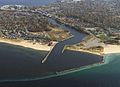
 Downtown Manistee Aerial View.jpg 3,389 × 2,268; 2.86 MB
-
 Downtown Manistee.jpg 3,414 × 2,268; 2.39 MB
-
 Manistee Breakwater Historic Catwalk.jpg 1,280 × 853; 217 KB
-
 Manistee Courthouse Fountain.jpg 1,018 × 1,280; 471 KB
-
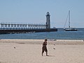
 Manistee Harbor.jpg 667 × 486; 103 KB
-
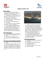 ManisteeHarbor.pdf 1,275 × 1,650, 2 pages; 737 KB
-
 Nels built 1892 longcase clock.JPG 1,536 × 2,048; 1.19 MB
-
 Panoramic of the Manistee River.jpg 3,768 × 1,371; 1.92 MB
-
 Portrett av Axel Ludvig Larsen a.k.a. Louis A. Larson (1865 - 1909) (8684600436).jpg 1,138 × 1,841; 1.85 MB
-
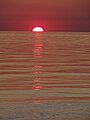
 Setting sun over Lake Michigan from Manistee, Michigan.JPG 4,896 × 3,672; 5.57 MB
-
 Sunset on Lake Michigan from Manistee, Michigan.JPG 3,672 × 4,896; 5.75 MB
-
 The loop at Orchard Beach, Manistee, Michigan -- electric trolley interurban..jpg 1,103 × 673; 1.07 MB
-
 Waterfront of downtown Manistee, Michigan.jpg 600 × 406; 64 KB


.jpg)
.jpg)

_(%22Welcome_Senator_Stabenow%22).jpg)
_(cropped).jpg)
.jpg)


_(8684600436).jpg)


