Category:Map of Ghent by Harrewijn
Subcategories
This category has the following 2 subcategories, out of 2 total.
Media in category "Map of Ghent by Harrewijn"
The following 5 files are in this category, out of 5 total.
-
 Gand-gent-belgium-antique-city-plan-by-harrewijn-1720.jpg 1,000 × 1,000; 249 KB
-
 Ghent by Harrewijn in 1720.jpg 802 × 622; 225 KB
-
 GHENT by J. Harrewyn, 1720.jpg 536 × 415; 47 KB
-
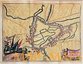
 Map of Ghent, 1750.JPG 490 × 411; 61 KB
-
 Map of Ghent, c 1700.jpg 1,680 × 1,359; 883 KB


