Category:Maps about the COVID-19 pandemic in England
Subcategories
This category has only the following subcategory.
Media in category "Maps about the COVID-19 pandemic in England"
The following 16 files are in this category, out of 16 total.
-
 Blackburn & Darwen extent of Coronavirus restrictions from 22-8-20.png 2,681 × 1,467; 3.4 MB
-
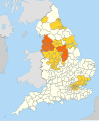
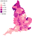 COVID-19 outbreak England per capita cases map.svg 1,440 × 1,627; 711 KB
-
 COVID-19 outbreak England per COVID Alert Level System map.svg 512 × 581; 84 KB
-
 COVID-19 restriction tiers in England from Wednesday 2 December 2020.png 602 × 704; 425 KB
-
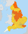
 England COVID-19 alert levels by district (16-18 Dec 2020).svg 1,108 × 1,345; 507 KB
-
 England COVID-19 alert levels by district (19 Dec 2020).svg 1,108 × 1,345; 507 KB
-
 England COVID-19 alert levels by district (2-15 Dec 2020).svg 1,108 × 1,345; 507 KB
-
 England COVID-19 alert levels by district (20-25 Dec 2020).svg 1,108 × 1,345; 1.35 MB
-
 England COVID-19 alert levels by district (26-30 Dec 2020).svg 1,108 × 1,345; 507 KB
-
 England COVID-19 alert levels by district (31 Dec 2020 - 5 Jan 2021).svg 1,108 × 1,345; 507 KB
-
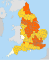
 England COVID-19 alert levels by district.svg 1,108 × 1,345; 504 KB
-
 Geographical spread of COVID-19 in England.pdf 1,500 × 843; 241 KB
-
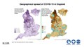
 Geographical spread of COVID-19 in England.png 931 × 576; 692 KB
-
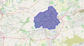
 Leicestershire-lockdown-boundary-map.jpg 1,106 × 1,087; 1.18 MB
-
 Map of COVID-19 vaccination sites in England.pdf 4,964 × 7,020; 8.8 MB
-
 Second England COVID-19 alert levels by district.svg 1,108 × 1,345; 507 KB


.svg)
.svg)
.svg)
.svg)
.svg)
.svg)


