Category:Maps about the COVID-19 pandemic in Syria
Media in category "Maps about the COVID-19 pandemic in Syria"
The following 22 files are in this category, out of 22 total.
-
 COVID-19 cases in Syria 19 May.png 1,054 × 975; 128 KB
-
 COVID-19 cases Syria August '20.png 1,621 × 1,080; 161 KB
-
 COVID-19 map after 2 added.png 1,080 × 1,037; 209 KB
-
 COVID-19 Outbreak Cases in Syria.svg 1,000 × 919; 29 KB
-
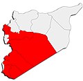
 Covid-19 pandemic in Syria up to the end of August.png 1,621 × 1,080; 141 KB
-
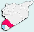 COVID-19 Syria 05.jpg 996 × 939; 59 KB
-
 COVID-19 Syria 14june.jpg 2,289 × 2,234; 140 KB
-
 COVID-19 Syria as 14 June.jpg 1,023 × 949; 54 KB
-
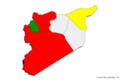
 COVID-19 Syria DRDS4.jpg 1,080 × 1,002; 110 KB
-
 COVID-19 Syria June 1st.jpg 1,067 × 1,007; 104 KB
-
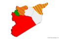
 COVID-19 Syria Rojava.jpg 327 × 300; 15 KB
-
 Covis in Syria.png 1,621 × 1,080; 134 KB
-
 Map Chart of COVID-19 cases in Syria.png 1,600 × 1,066; 152 KB
-
 Syria covid 19 map.png 1,600 × 1,066; 161 KB
-
 Syria COVID-19.png 1,600 × 1,066; 160 KB
-
 Syria Map Chart coronavirus 19-20.png 1,600 × 1,066; 160 KB
-
 Syria Map Chart coronavirus.png 1,600 × 1,066; 159 KB
-
 Syria Map Chart CoViD.png 1,600 × 1,066; 153 KB
-
 Syria Map Chart of corona cases.png 1,600 × 1,066; 157 KB
-
 Syria Map Chart of covid.png 1,600 × 1,066; 164 KB
-
 Syria Map Chart of covid19.png 1,600 × 1,066; 158 KB
-
 Syria Map covid.png 1,600 × 1,066; 143 KB


