Category:Maps by Bartholomew
Subcategories
This category has only the following subcategory.
Media in category "Maps by Bartholomew"
The following 12 files are in this category, out of 12 total.
-
 1892 Tourist's New Map of Scotland - Geographicus - Scotland-bartholomew-1892.jpg 3,500 × 4,567; 4.73 MB
-
 Bathy-orographical map of the world.jpg 2,428 × 1,606; 1.23 MB
-
 Cromartyshire 1892.jpg 1,243 × 729; 537 KB
-
 Early voyagers, 1492.jpg 1,902 × 1,466; 1.03 MB
-
 Land surface features and ocean currents, 1890.jpg 4,354 × 3,224; 2.02 MB
-
 Mapping of the world, 1922.jpg 5,651 × 4,026; 4.61 MB
-
 Ocean currents and land features, 1887.jpg 3,094 × 2,274; 840 KB
-
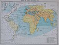
 Routes to India, 1893.jpg 2,222 × 1,725; 963 KB
-
 The Old World - Early explorers.jpg 1,649 × 1,366; 1.3 MB
-
 The World on Sir John Herschel's Projection, 1871.jpg 4,109 × 2,966; 3.26 MB
-
 United Nations Map of the World.jpg 11,103 × 8,188; 23.92 MB
-
 Yorkshire. Maps and plans by Bartholomew (1890) (14781482402).jpg 4,380 × 2,191; 1.91 MB


_(14781482402).jpg)