Category:Maps by Friedrich von Stülpnagel (cartographer)
Media in category "Maps by Friedrich von Stülpnagel (cartographer)"
The following 9 files are in this category, out of 9 total.
-
 1841 Perthes Map of Ireland - Geographicus - Ireland-perthes-1841.jpg 4,000 × 3,258; 3.43 MB
-
 Stieler-Stulpnagel Nord-America 1848 UTA.jpg 5,420 × 4,414; 6.55 MB
-
 Stieler-Stulpnagel Verein-Staaten von Nord-America, Mexico, Yucatan u. A. 1848 UTA.jpg 6,137 × 5,068; 9.77 MB
-

-
 Nord-America (3120218629).jpg 2,000 × 1,660; 3.22 MB
-
 Stülpnagel, Grundriss von Erfurt 1826.jpg 1,600 × 1,508; 1.19 MB
-
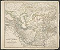 Vorder-Asien.jpg 5,351 × 4,501; 9.16 MB
-
 West-Indien und Centro-America.jpg 5,742 × 4,629; 7.17 MB
-
 Westliche halbkugel (3120218905).jpg 2,000 × 1,675; 2.86 MB


.jpg)


.jpg)