Category:Maps by George W. Boynton
Subcategories
This category has the following 2 subcategories, out of 2 total.
Media in category "Maps by George W. Boynton"
The following 24 files are in this category, out of 24 total.
-
1839 map Boston Deaborn 2674434011.jpg 1,901 × 2,000; 3.89 MB
-
1844 WinterSt map Boston BPL 10941 detail.png 696 × 707; 967 KB
-
A Map of Washington's Farms at Mt. Vernon (1830 engraving).jpg 4,408 × 2,489; 10.93 MB
-
Battle of Brandywine 1777.jpg 2,672 × 4,567; 9.84 MB
-
Bulfinch Triangle detail of 1844 Boynton Plan of the City of Boston.JPG 1,181 × 717; 257 KB
-
China LOC 2006629360.jpg 4,448 × 3,745; 3.22 MB
-
China LOC 2006629360.tif 4,448 × 3,745; 47.66 MB
-
Delaware LOC 2017593558.jpg 4,056 × 4,908; 2.26 MB
-
Encampment at Valley Forge 1778.jpg 4,350 × 2,676; 7.93 MB
-
Map of the city of Lowell - surveyed in 1841 by order of the municipal authorities LOC 2012592604.tif 10,992 × 9,505; 298.92 MB
-
Map of the Petersburg Railroad in 1838.jpg 418 × 714; 78 KB
-
Massachusetts map by George W. Boynton, 1844.jpg 3,826 × 2,841; 15.79 MB
-
Massachusetts map by George W. Boynton, 1846.jpg 4,035 × 2,961; 20.92 MB
-
Massachusetts map by George W. Boynton, 1851.jpg 3,969 × 2,885; 4.67 MB
-
Massachusetts map by George W. Boynton, 1852.jpg 4,693 × 3,329; 5.97 MB
-
Battle of Brandywine, Sept. 11th 1777 (NYPL b15271067-434988).jpg 4,688 × 4,976; 3.14 MB
-
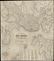
Plan of Boston with parts of the adjacent towns (2674427051).jpg 2,000 × 1,473; 2.84 MB
-
Plan of the Battle of Braddock's Defeat at the beginning of action July 9, 1755.jpg 2,658 × 4,531; 9.67 MB
-
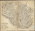
Plan of the city of Boston (2674416495).jpg 2,000 × 1,739; 3.57 MB
-
Tuttle Boynton-United-States-2898x3000.jpg 2,898 × 3,000; 856 KB
-
United States - Geo. Boynton, sc., Boston. NYPL434846.tiff 4,376 × 5,979; 74.86 MB


