Category:Maps by Giacomo Gastaldi
Subcategories
This category has the following 2 subcategories, out of 2 total.
M
- Maps of Asia by Abraham Ortelius (29 F)
Media in category "Maps by Giacomo Gastaldi"
The following 77 files are in this category, out of 77 total.
-
 Gastaldi Nueva Hispania Tabula Nova 1548 UTA.jpg 2,620 × 2,100; 1.83 MB
-
 Rossia Blanca.jpg 1,324 × 1,050; 1.34 MB
-
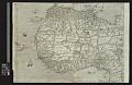
 1550 Africa Ramusio Delle Navigationi vol1.png 595 × 939; 246 KB
-
 1551 Venice Gastaldi-Descriptione de la Moscouia cropped.jpg 2,869 × 1,753; 1.35 MB
-
 1551 Venice Gastaldi-Descriptione de la Moscouia.jpg 5,168 × 3,816; 3.31 MB
-
 1554 Africa Delle Navigationi et Viaggi.jpg 705 × 505; 146 KB
-
 Ramusio & Gastaldi Universale della Parti della Mondo 1556 UTA.jpg 2,881 × 2,303; 3.85 MB
-
 1556 map of Sumatra by Giacomo Gastaldi.jpg 6,252 × 4,678; 5.77 MB
-

-
 1561 map of East Asia by Giacomo Gastaldi, published in 1580.jpg 18,351 × 15,925; 41.77 MB
-
 1561 map of East Asia by Giacomo Gastaldi.jpg 17,798 × 11,612; 33.79 MB
-
 1565 Brasil Ramusio Delle Navigationi vol3 pp427-428.png 1,104 × 872; 2.74 MB
-
 1565 Hispaniola Ramusio Delle Navigationi vol3 p44.png 888 × 547; 1.37 MB
-
 1565 Mexico Ramusio Delle Navigationi vol3 p308.png 545 × 863; 1.32 MB
-
 1565 Sumatra Ramusio Delle Navigationi vol3 pp433-434.png 1,119 × 878; 2.84 MB
-
 1565 West Africa Ramusio Delle Navigationi vol3 pp430-431.png 1,116 × 879; 2.71 MB
-
 1570 map of Asia Minor by Giacomo Gastaldi.jpg 1,609 × 1,200; 569 KB
-
 1570 map of Asia minor.jpg 11,428 × 8,761; 20.71 MB
-
 Modern Geographic Table of Geography WDL2579.jpg 1,331 × 1,024; 483 KB
-

-

-

-
 Arabia Felice Nuova Tavola 1574.jpg 3,510 × 2,552; 1.19 MB
-
 Arabia Felice Nuova Tavola 2.jpg 3,510 × 2,552; 1.2 MB
-
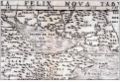
 Arabia Felix Nova Tabula.jpg 652 × 503; 126 KB
-
 Asiae Nova Descriptio 1574.JPG 4,457 × 3,444; 14.52 MB
-
 Basic cartouche on a Persia map by de Jode.jpg 3,693 × 1,712; 920 KB
-
 Basic cartouche on an Arabia map by de Jode.jpg 2,976 × 2,261; 1.58 MB
-
 Carta marina nuova tavola. LOC 84696977.jpg 3,775 × 2,898; 1.66 MB
-
 Carta marina nuova tavola. LOC 84696977.tif 3,775 × 2,898; 31.3 MB
-
 Cartouche on an Asia map by Gastaldi.JPG 1,175 × 929; 1.04 MB
-
 Caucasus (Asiae Nova Descriptio 1574).JPG 1,143 × 871; 309 KB
-
 Corfou 1570.jpg 129 × 294; 44 KB
-

-
 Europae Tabula VIII, Giacomo Gastaldi (Venice, 1548).jpg 2,500 × 1,878; 1.8 MB
-
 Gastaldi - Geografia particolare.jpg 1,354 × 1,054; 885 KB
-
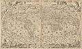
 Gastaldi 1548 MapOfTheWorld Reproduction 1904.jpg 1,193 × 884; 929 KB
-
 Gastaldi Map.tif 4,475 × 3,286; 41.21 MB
-
 Gastaldi, Giacomo – Parte de l'Africa, 1565 – BEIC IE8997249.jpg 5,572 × 4,198; 11.38 MB
-
 Gastaldi, Giacomo – Prima tavola, 1588 – BEIC IE8994024.jpg 2,933 × 2,180; 7.08 MB
-
 Gastaldi-2.jpg 1,200 × 1,200; 228 KB
-
 Gastaldi.jpg 1,200 × 1,000; 242 KB
-
 Gastaldis Arabia Deserta.JPG 2,866 × 2,124; 2.1 MB
-
 Gerard de Jode version, Prime Partos Asia (Antwerp, 1577).A.jpg 7,900 × 4,333; 2.47 MB
-
 Gerard de Jode version, Prime Partos Asia (Antwerp, 1577).jpg 13,767 × 8,150; 12.11 MB
-

-
 Houghton 51-2493 - Cosmographia universale et exactissima, 1569.jpg 2,341 × 1,410; 1.67 MB
-

-

-

-

-

-
 Island13x1024.jpg 1,024 × 792; 112 KB
-
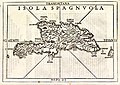 Isola Spagnuola.jpg 1,800 × 1,281; 850 KB
-
 Leibnizer Fig 8 Gastaldi map (1560).jpg 1,468 × 1,479; 267 KB
-
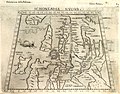
 Lucas 1898 Plate 6 Gastaldi Schonlandia Nova 1548 annalsofvoyageso00luca 0279.jpg 3,272 × 2,410; 1.27 MB
-
-
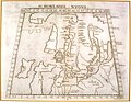
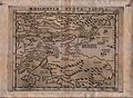 Moschovia Nova Tabula.jpg 1,760 × 1,287; 473 KB
-
-
 PG 1548.jpg 483 × 331; 68 KB
-
 Primae Partis Asiae acurata delineatio.jpg 12,909 × 8,050; 16.14 MB
-
 Schonladia nuova.tif 4,957 × 3,730; 52.9 MB
-
 Secundae Partis Asiae.jpg 13,258 × 9,107; 24.59 MB
-
 Si0133x1024.jpg 1,024 × 806; 245 KB
-
 Sumatra-Gastaldi.jpg 1,000 × 752; 189 KB
-
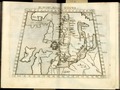
 Tabula Asiae II.jpg 1,024 × 816; 233 KB
-
 Tabula Asiae VIII.jpg 4,469 × 3,459; 3.61 MB
-
 UBBasel Map 1556 Kartenslg AA 70 Piamonte.tiff 12,062 × 9,700, 2 pages; 334.77 MB
-
 UBBasel Map 1561 Kartenslg AA 95-95a Asia.tiff 12,587 × 9,590, 2 pages; 540.18 MB
-
 UBBasel Map 1561 Kartenslg AA 96-97 Asia.tiff 8,266 × 12,422, 2 pages; 587.9 MB
-
 UBBasel Map 1564 Kartenslg AA 110-113.tif 14,037 × 9,132, 4 pages; 1.39 GB
-
 UBBasel Map 1566 Kartenslg AA 92 Transilvania.tiff 12,013 × 9,735, 2 pages; 334.61 MB
-
 UBBasel Map 1568 Kartenslg AA 69 territorio Padoano.tiff 12,062 × 9,700, 2 pages; 334.77 MB
-
 UBBasel Map Dalmatien Istrien Italien Korsika 1570-1590 Kartenslg Mappe 239-1.tif 9,509 × 6,122, 2 pages; 166.58 MB
-
 UBBasel Map Griechenland Ägäis 1569 Kartenslg Mappe 250-30d.tif 11,012 × 8,612, 2 pages; 271.35 MB
-
 UBBasel Map Rumänien Bulgarien Walachei Moldau 1584 Kartenslg Mappe 250-21.tif 9,926 × 7,005, 2 pages; 376.25 MB
-
 Weltkarte-ptolemaeus-ausgabe-1548 1-1200x890.jpg 1,200 × 890; 389 KB


%27_(11204905225).jpg)

_vicinarvmqe_regionum,_vti_Bvlgariae,_Walachiae,_Syrfiae,_etc._descriptio.jpg)


.JPG)


.jpg)


.A.jpg)
.jpg)
.jpg)


.jpg)


