Category:Maps by Ulamm
Media in category "Maps by Ulamm"
The following 200 files are in this category, out of 262 total.
(previous page) (next page)-
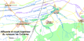
 1789 + 2022 Auvergne-Rhône-Alpes, noms.png 1,416 × 1,209; 206 KB
-
 1789 + 2022 Bourgogne-Franche-Comté, noms.png 1,451 × 1,290; 222 KB
-
 1789 + 2022 Bretagne, noms.png 1,135 × 873; 101 KB
-
 1789 + 2022 France, noms des régions.png 4,264 × 4,098; 1.34 MB
-
 1789 + 2022 Grand Est, noms.png 1,583 × 1,125; 210 KB
-
 1789 + 2022 Hauts-de-France + Île, noms.png 866 × 1,378; 136 KB
-
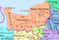 1789 + 2022 Normandie, noms.png 1,228 × 836; 117 KB
-
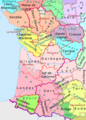 1789 + 2022 Nouvelle Aquitaine, noms.png 1,361 × 1,895; 277 KB
-
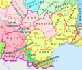 1789 + 2022 Occitanie, noms.png 1,483 × 1,260; 204 KB
-
 1789 + 2022 Pays de la Loire, noms.png 1,130 × 1,134; 150 KB
-
 1789 + 2022 Provence, noms.png 984 × 914; 100 KB
-
 1789 + 2022 Île-de-France216.png 2,025 × 1,554; 595 KB
-
 1789 et 2022, Centre-Val de Loire et Île-de-France, noms.png 1,200 × 1,368; 188 KB
-
 Achadinha - Nossa Senhora do Rosario.png 1,134 × 1,438; 681 KB
-
 Albanchez de Mágina, Iglesia de la Asunción.png 1,362 × 1,440; 811 KB
-
 Alcaudete Pedro Maria Clara E=Carmen.png 2,218 × 1,490; 1.01 MB
-
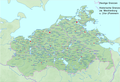
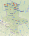
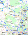
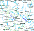
 Aller Flusssystem topo.png 1,974 × 2,703; 7.54 MB
-
 Andrés, Rublacedo de Abajo.png 2,240 × 1,367; 1.42 MB
-
 Ankershagen Havelquelle.gif 225 × 212; 5 KB
-
 Antequera San Juan Bautista.png 1,924 × 1,322; 1.08 MB
-
 Ardennen03.png 1,095 × 917; 150 KB
-
 Ardglass, Co. Down, 2 x St Nicholas.png 2,232 × 1,416; 1.05 MB
-
 Açores, Madeira, Canarias.png 2,452 × 1,400; 1.13 MB
-
 Backstein Gotik Bayern.png 1,106 × 1,068; 2.4 MB
-
 Backstein Gotik Schweiz.png 538 × 342; 444 KB
-
 Backsteingotik Altmark Jerichow.png 1,806 × 1,126; 3.21 MB
-
 Backsteingotik Belgien.png 2,044 × 1,512; 5.34 MB
-
 Backsteingotik Brandenburg.png 1,076 × 1,131; 1.82 MB
-
 Backsteingotik Bremen Groningen.png 1,195 × 794; 734 KB
-
 Backsteingotik HU, HR, SK.png 537 × 441; 417 KB
-
 Backsteingotik in Estland und Lettland.png 600 × 632; 551 KB
-
 Backsteingotik in Polen.png 2,205 × 2,075; 6.82 MB
-
 Backsteingotik Jütland+Fünen.png 1,160 × 2,003; 2.38 MB
-
 Backsteingotik Mecklenburg-Vorpommern.png 1,344 × 923; 1.56 MB
-
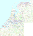 Backsteingotik Niederlande.png 1,528 × 1,653; 2.62 MB
-
 Backsteingotik Niedersachsen.png 1,355 × 1,117; 2.51 MB
-
 Backsteingotik Nordsee0tx.png 3,002 × 2,124; 5.69 MB
-
 Backsteingotik NRW.png 717 × 946; 660 KB
-
 Backsteingotik Sachsen-Anhalt.png 942 × 1,164; 1.9 MB
-
 Backsteingotik Sachsen.png 402 × 295; 256 KB
-
 Backsteingotik Schleswig-Holstein.png 538 × 472; 456 KB
-
 Backsteingotik Schweden.png 576 × 890; 317 KB
-
 Backsteingotik Sjælland.png 1,939 × 2,288; 3.95 MB
-
 Backsteingotik untere Weichsel.png 674 × 1,073; 1.13 MB
-
 Bangor - R.C. St. Comgall's & C.o.I. Abbey.png 2,216 × 1,394; 1.19 MB
-
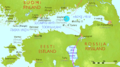
 Basken Lage.png 338 × 315; 6 KB
-
 Belte inter.png 566 × 600; 681 KB
-
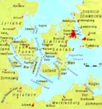 Belte.png 840 × 890; 283 KB
-
 Bergen Hardangerfjord.png 511 × 506; 97 KB
-
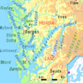
 Bergen Stavanger Fjorde.png 511 × 787; 140 KB
-
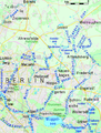
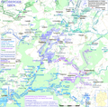
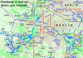 Berliner Gewässer.png 2,930 × 2,046; 4.21 MB
-
 Bitwy Rugia 1168, Darß 1184.png 1,409 × 908; 218 KB
-
 Bremen Rathaus Markt Bürgerschaft Uns.Lb.Frauen.png 1,050 × 1,390; 117 KB
-
 Bremer Staatsgebiet seit 1800.png 656 × 1,056; 33 KB
-
 Brick Gothic around northern Baltic Sea, labelled.png 3,030 × 2,252; 7.77 MB
-
 Brick Gothic Czechia.png 534 × 337; 402 KB
-
 Brick Gothic Finland.png 574 × 471; 427 KB
-
 Brick Gothic in Kaliningrad Oblast.png 645 × 494; 464 KB
-
 Brick Gothic Lithuania & Belarus.png 537 × 410; 388 KB
-
 Brick Gothic locations around northern Baltic Sea.png 3,030 × 2,252; 7.75 MB
-
 Brick Gothic Ukraine.png 321 × 335; 206 KB
-
 Brique gothique en France.png 2,302 × 2,235; 8.62 MB
-
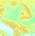
 BY + IT topo.png 2,481 × 2,534; 1.89 MB
-
 Cañizar de Argaño - iglesia.png 1,390 × 1,446; 594 KB
-
 Chamagudao.png 1,183 × 869; 1.74 MB
-
 Conventer see.png 970 × 561; 36 KB
-
 Crépy-en-V. - Bouillant - St-Martin et St-Germain.png 2,150 × 1,318; 988 KB
-
 CZ Cechy Morava kraje.gif 805 × 468; 21 KB
-
 DanewerkKograben.gif 1,098 × 984; 21 KB
-
 Darß bitwa 1184.png 1,409 × 908; 219 KB
-
 Dickelsmoor Augsburg.png 898 × 796; 32 KB
-
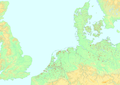
 DK osm without Bornholm.png 2,046 × 2,304; 2.61 MB
-
 Donge met Leij.png 2,380 × 3,956; 4.72 MB
-
 Duemmer Hunte.png 418 × 483; 25 KB
-
 Dundee St Salvador's Church loc.png 2,308 × 1,392; 925 KB
-
 Eider Treene2.gif 1,244 × 1,024; 104 KB
-
 Ems Flusssystem topo.png 2,091 × 2,925; 5.72 MB
-
 Ems river system topo.png 2,091 × 2,925; 5.72 MB
-
 Erpe & Wuhle.png 942 × 1,242; 469 KB
-
 Erzbistum Bremen 1245–1517.png 911 × 688; 128 KB
-
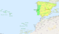 ES + PT + islas.png 3,334 × 1,911; 1.92 MB
-
 Estebanvela - San Pedro.png 1,402 × 1,406; 732 KB
-
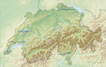
 F-CH-CA topo.png 2,485 × 2,534; 1.7 MB
-
 Feldberger Seen + Abflusswege.png 2,609 × 2,574; 2.25 MB
-
 Feldberger Seen zur Havel & zur Ucker.png 5,083 × 3,080; 5.66 MB
-
 Floßgraben & Kammerkanal.png 1,902 × 1,038; 863 KB
-
 Fore St Feichin's ruin, map.png 1,128 × 1,530; 440 KB
-
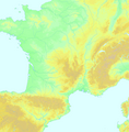
 FR osm 0tx.png 2,708 × 2,612; 7.5 MB
-
 France 1789 + 2022.png 4,264 × 4,098; 1.26 MB
-
 France1860cheminsdefer.png 783 × 800; 32 KB
-
 Frankreich1860Bahnstrecken.png 783 × 800; 32 KB
-
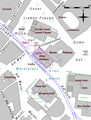
 Friedrichstadt Plan.png 1,716 × 2,196; 134 KB
-
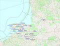
 Frieslande.png 2,599 × 1,423; 280 KB
-
 Fyn+Sjælland osm.png 1,381 × 1,147; 931 KB
-
 Gamengrund Reliefkarte.png 3,147 × 8,344; 756 KB
-
 Gamengrund Süd.png 3,147 × 4,096; 435 KB
-
 Glien, Muhrgraben, Ruppiner Kan.png 1,324 × 1,656; 689 KB
-
 Godendorfer Mühlenbach-Hegensteinfließ.png 2,376 × 2,577; 1.84 MB
-
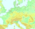
 Gothic brick Europe conical map.png 1,810 × 1,882; 3.41 MB
-
 Gothic brick Europe labelled.png 4,201 × 3,543; 19.35 MB
-
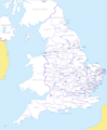 Gothic brick in England.png 2,103 × 2,547; 1,011 KB
-
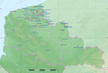 Gothique de brique en Flandre-Française.png 715 × 486; 621 KB
-
 Gotik Backstein Italien.png 3,758 × 4,296; 18.5 MB
-
 Gotischer Backstein - Frankreich, Italien, Donau.png 5,242 × 2,252; 18.95 MB
-
 Gotischer Backstein Nordsee & westl. Ostsee.png 3,173 × 2,243; 6.94 MB
-
 Gotischer Backstein um Nord- & südliche Ostsee.png 5,248 × 2,250; 11.33 MB
-
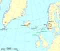
 Grønland+grid.png 329 × 609; 25 KB
-
 Grønlands–Noreg72c.png 600 × 910; 45 KB
-
 Haller Wilhelm2.png 851 × 620; 32 KB
-
 Haut Calavon, Riaille, Largue+loc.png 509 × 1,437; 1.17 MB
-
 Havelkanal & Sacrow-Paretzer Kanal.png 1,400 × 1,523; 918 KB
-
 Havelkanal.gif 1,296 × 864; 46 KB
-
 Havelland FHSW.gif 1,035 × 781; 129 KB
-
 HavelRhin.gif 1,394 × 1,394; 126 KB
-
 HB Altstadt Süd OSM+Murtfeldt.png 1,331 × 1,593; 1.67 MB
-
 Hessen Kreise Namen.png 1,466 × 2,048; 5.72 MB
-
 Hessen phys Karte.gif 566 × 692; 310 KB
-
 Hogland Suursaari.png 2,571 × 1,434; 259 KB
-
 HU-HR-SR topo.png 2,481 × 2,534; 2.02 MB
-
 Hunte pos.png 418 × 483; 24 KB
-
 Iglesia de San Andrés, Villasilos, Burgos.png 1,804 × 1,340; 1.33 MB
-
 Iglesia de Santiago, Totana.png 2,338 × 1,402; 1.62 MB
-
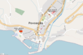 Igrejas de Povoação.png 2,108 × 1,410; 1.02 MB
-
 Irish Sea – relief, ports, limits.tif 1,043 × 1,507; 4.5 MB
-
 IrishSeaReliefMap.jpg 1,043 × 1,507; 2.15 MB
-
 IrishSeaReliefmap.png 1,043 × 1,507; 535 KB
-
 JadeWeser.png 3,365 × 3,231; 655 KB
-
 JadeWeser1362.png 3,365 × 3,231; 621 KB
-
 Janajana.png 679 × 634; 131 KB
-
 Jaramillo Quemado - San Martín.png 2,192 × 1,302; 1.44 MB
-
 Jylland Fjorder SH Förden.png 816 × 2,524; 202 KB
-
 K0nigl+herzoglPreussen.png 1,036 × 756; 42 KB
-
 Kanal Jagiellonski.gif 500 × 674; 16 KB
-
 Karte Altmyhl.gif 419 × 379; 19 KB
-
 Kells St Colmcille's RC map.png 2,284 × 1,186; 1.34 MB
-
 Kühlung LRO.png 1,876 × 1,589; 184 KB
-
 Laferté-sur-Aube - Sainte-Marie-Madeleine.png 1,428 × 1,392; 1.14 MB
-
 Landgebiete der Freien Stadt Bremen.png 918 × 1,316; 76 KB
-
 Lanty-sur-Aube - Saint-Laurent.png 2,386 × 1,258; 605 KB
-
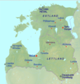
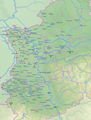
 Latvija 2021 DE.png 5,000 × 3,200; 1.26 MB
-
 Latvija 2021.png 5,000 × 3,200; 1.25 MB
-
 Lena baikal.png 628 × 1,217; 55 KB
-
 Leoprechting Niedertaufk NM-St.-Veit Massing.png 1,502 × 1,362; 1.73 MB
-
 Les Collières DE.png 3,000 × 1,469; 241 KB
-
 Les Collières FR.png 3,000 × 1,469; 241 KB
-
 Lietuvos savivaldybės D.png 2,571 × 1,970; 424 KB
-
 Lietuvos savivaldybės.png 2,571 × 1,970; 415 KB
-
 Luche FHSW.gif 811 × 459; 61 KB
-
 Lychener Gewässer.png 3,153 × 2,628; 2.76 MB
-
 Map of the Gothic brick buildings in Europe.png 4,201 × 3,543; 17.7 MB
-
 Mapa del gótico-mudéjar de ladrillos.png 1,076 × 1,269; 2.57 MB
-
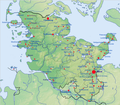
 Mecklenburg-Vorpommern Gewässer.png 1,562 × 1,190; 117 KB
-
 Mecklenburg-Vorpommern.gif 1,562 × 1,190; 360 KB
-
 Mittelsachsen.gif 439 × 350; 76 KB
-
 Mittlere Ostsee b3.png 1,194 × 723; 382 KB
-
 Montvalezan St-Jean-Baptiste.png 2,578 × 1,382; 2.91 MB
-
 Méry-sur-Seine, église de l'Assomption.png 1,774 × 1,410; 1.13 MB
-
 N+M Jylland osm.png 1,294 × 1,661; 973 KB
-
 Nedereems.png 2,085 × 2,085; 2.02 MB
-
 Netphen ev. Martinikirche.png 2,292 × 1,342; 1.83 MB
-
 Newry - Catherine, Cathedral, Mary, 1st Presb.png 2,232 × 1,394; 2.1 MB
-
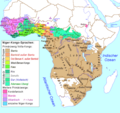
 Niger-Congo map.png 1,207 × 1,139; 132 KB
-
 Niger-Kongo-Karte.png 1,207 × 1,139; 138 KB
-
 Nigeria Benin Cameroon languages.png 1,522 × 1,388; 83 KB
-
 Nigeria Benin Kamerun Sprachen.png 1,522 × 1,388; 65 KB
-
 Nigeria Sprachfamilien.png 1,200 × 1,200; 46 KB
-
 Nordburg bei der Aller (evtl. Mundburg).png 1,488 × 1,282; 1.16 MB
-
 Nordsee EN-B-DK.png 3,742 × 2,503; 1.7 MB
-
 Noreg-Grønland3.png 2,106 × 1,784; 183 KB
-
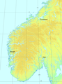
 Noreg16.png 804 × 1,144; 29 KB
-
 Norge Fjorder1.png 993 × 1,683; 81 KB
-
 Norge teglstein.png 2,119 × 2,848; 4.47 MB
-
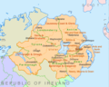 Northern Ireland counties + districts.png 1,672 × 1,343; 441 KB
-
 NRW Landsch Fluesse.png 1,432 × 1,354; 896 KB
-
 NRW2Orte.gif 606 × 608; 203 KB
-
 Oberschlesien 1921 Voten.png 411 × 323; 13 KB
-
 Obertaufkirchen-Kirchkagen, Heldenstein, Isen.png 1,138 × 978; 1.08 MB
-
 Oblast Kaliningrad OSM 0 labels.png 1,546 × 1,179; 1.21 MB
-
 Oksywie Wielbark Przeworsk.gif 830 × 626; 21 KB
-
 Osnabrueckhbf.gif 441 × 383; 26 KB
-
 Ostsee NO physisch.png 5,592 × 4,097; 4.42 MB
-
 Ostseetiefen.png 826 × 985; 94 KB
-
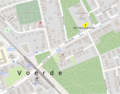 Pauluskirche Voerde.png 1,784 × 1,392; 1.48 MB
-
 Peene & Trebel.png 689 × 737; 105 KB
-
 Peene-Südkanal.png 588 × 496; 12 KB
-
 Peene.png 938 × 737; 135 KB
-
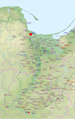
 PL Dolna Wisła.png 1,000 × 1,596; 2.1 MB
-
 PL hipsometria, Krajna, Pojezierze Krajenskie.png 3,389 × 3,035; 4.88 MB
-
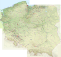
 Poland NE.png 2,744 × 2,361; 8.47 MB
-
 Poland NW.png 2,388 × 2,315; 6.62 MB
-
 Poland SE.png 2,744 × 2,687; 9.72 MB
-
 Poland SW.png 2,695 × 2,326; 7.83 MB
-
 Potsdam Spandau Bahn Wasser.png 1,400 × 1,523; 919 KB
-
 Presle église Saint-Vincent.png 2,448 × 1,386; 1.78 MB
-
 Quillow & Strom.png 3,315 × 2,573; 2.95 MB
-
 Raille - Oron.png 2,257 × 801; 99 KB
-
 Recknitz.png 1,413 × 2,238; 2.95 MB
-
 Rhone bassin topo.png 3,745 × 5,568; 33.54 MB
-
 Rijn-Maas-water %.png 1,200 × 1,299; 67 KB
-
 Rotes Luch.gif 1,062 × 743; 135 KB


.png)


