Category:Maps created by User:Mr. Matté
Media in category "Maps created by User:Mr. Matté"
The following 200 files are in this category, out of 2,637 total.
(previous page) (next page)-
 LA 1 map.svg 1,422 × 833; 210 KB
-
 LA 2 map.svg 1,205 × 709; 1.96 MB
-
 LA 2 Alternate map.svg 1,205 × 709; 385 KB
-
 LA 3 map.svg 1,205 × 709; 1.05 MB
-
 PA 3 map.svg 1,204 × 708; 134 KB
-
 LA 4 map.svg 1,205 × 709; 991 KB
-
 LA 5 map.svg 1,205 × 709; 775 KB
-
 LA 6 map.svg 1,205 × 709; 694 KB
-
 LA 8 map.svg 1,205 × 709; 1.7 MB
-
 Pennsylvania Route 8 map.svg 1,204 × 708; 559 KB
-
 LA 9 map.svg 1,205 × 709; 2.19 MB
-
 Delaware Route 1A map.svg 2,011 × 1,184; 219 KB
-
 US 1 Business NJ map.svg 1,208 × 712; 198 KB
-
 LA 10 map.svg 1,205 × 709; 164 KB
-
 PA 10 map.svg 1,204 × 708; 646 KB
-
 U.S. Route 11 in Pennsylvania map.svg 1,204 × 708; 547 KB
-
 LA 12 map.svg 1,205 × 709; 498 KB
-
 Warren Street Bypass map.svg 1,204 × 708; 933 KB
-
 LA 13 map.svg 1,205 × 709; 1.94 MB
-
 LA 14 map.svg 1,205 × 709; 1.2 MB
-
 LA 15 map.svg 1,205 × 709; 2.53 MB
-
 U.S. Route 15 in Pennsylvania map.svg 1,204 × 708; 532 KB
-
 LA 16 map.svg 1,205 × 709; 1.59 MB
-
 LA 17 map.svg 1,205 × 709; 730 KB
-
 Pennsylvania Route 17 map.svg 1,204 × 708; 281 KB
-
 LA 18 map.svg 1,205 × 709; 1.96 MB
-
 Pennsylvania Route 18 map.svg 1,129 × 651; 555 KB
-
 LA 19 map.svg 1,205 × 709; 744 KB
-
 U.S. Route 19 in Pennsylvania map.svg 1,204 × 708; 544 KB
-
 Delaware Route 2 map.svg 2,011 × 1,184; 227 KB
-
 OH 2 map.svg 1,006 × 592; 1.44 MB
-
 VA 2 map.svg 1,205 × 709; 1.89 MB
-
 LA 21 map.svg 1,205 × 709; 1.09 MB
-
 LA 22 map.svg 1,205 × 709; 1.25 MB
-
 LA 23 map.svg 1,205 × 709; 3.53 MB
-
 LA 25 map.svg 1,205 × 709; 849 KB
-
 LA 26 map.svg 1,205 × 709; 1.25 MB
-
 LA 27 map.svg 1,205 × 709; 1.76 MB
-
 Pennsylvania Route 27 map.svg 1,204 × 708; 229 KB
-
 LA 28 map.svg 1,205 × 709; 1.62 MB
-
 LA 29 map.svg 1,205 × 709; 783 KB
-
 Delaware Route 3 map.svg 2,011 × 1,184; 211 KB
-
 OH 3 map.svg 1,006 × 592; 278 KB
-
 LA 30 map.svg 1,205 × 709; 555 KB
-
 LA 31 map.svg 1,205 × 709; 921 KB
-
 LA 33 map.svg 1,205 × 709; 714 KB
-
 LA 34 map.svg 1,205 × 709; 1.62 MB
-
 Pennsylvania Route 34 map.svg 1,204 × 708; 812 KB
-
 LA 35 map.svg 1,205 × 709; 1.16 MB
-
 Pennsylvania Route 35 map.svg 1,204 × 708; 481 KB
-
 LA 36 map.svg 1,205 × 709; 734 KB
-
 Pennsylvania Route 36 map.svg 1,204 × 708; 551 KB
-
 LA 37 map.svg 1,205 × 709; 604 KB
-
 LA 38 map.svg 1,205 × 709; 551 KB
-
 Pennsylvania Route 38 map.svg 1,204 × 708; 422 KB
-
 LA 39 map.svg 1,205 × 709; 3.69 MB
-
 Delaware Route 4 map.svg 2,011 × 1,184; 317 KB
-
 OH 4 map.svg 1,006 × 592; 269 KB
-
 VA 4 map.svg 1,205 × 709; 1.19 MB
-
 LA 40 map.svg 1,205 × 709; 930 KB
-
 U.S. Route 40 in Pennsylvania map.svg 1,204 × 708; 411 KB
-
 LA 41 map.svg 1,205 × 709; 824 KB
-
 Pennsylvania Route 41 map.svg 1,204 × 708; 317 KB
-
 LA 42 map.svg 1,205 × 709; 764 KB
-
 PA 42 map.svg 1,204 × 708; 529 KB
-
 LA 43 map.svg 1,205 × 709; 822 KB
-
 Mon-Fayette Expressway map.svg 1,204 × 708; 285 KB
-
 LA 44 map.svg 1,205 × 709; 739 KB
-
 LA 45 map.svg 1,205 × 709; 1.16 MB
-
 Pennsylvania Route 45 map.svg 1,204 × 708; 578 KB
-
 LA 46 map.svg 1,205 × 709; 2.03 MB
-
 Pennsylvania Route 46 map.svg 1,204 × 708; 262 KB
-
 LA 47 map.svg 1,205 × 709; 5.11 MB
-
 LA 48 map.svg 1,205 × 709; 2.18 MB
-
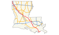
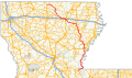
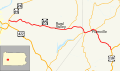
 I-49 (LA) 2014.svg 1,205 × 709; 91 KB
-
 LA 49 map.svg 1,205 × 709; 2.01 MB
-
 Pennsylvania Route 49 map.svg 1,204 × 708; 78 KB
-
 Delaware Route 5 map.svg 3,015 × 2,011; 721 KB
-
 OH 5 map.svg 1,006 × 592; 1.25 MB
-
 VA 5 map.svg 1,205 × 709; 925 KB
-
 LA 52 map.svg 1,205 × 709; 587 KB
-
 PA 52 map.svg 1,204 × 708; 496 KB
-
 Pennsylvania Route 53 map.svg 1,204 × 708; 485 KB
-
 LA 54 map.svg 1,205 × 709; 521 KB
-
 LA 55 map.svg 1,205 × 709; 932 KB
-
 LA 56 map.svg 1,205 × 709; 2.14 MB
-
 Pennsylvania Route 56 map.svg 1,204 × 708; 331 KB
-
 LA 57 map.svg 1,205 × 709; 2.17 MB
-
 Pennsylvania Route 58 map.svg 1,204 × 708; 372 KB
-
 LA 59 map.svg 1,205 × 709; 490 KB
-
 Pennsylvania Route 59 map.svg 1,204 × 708; 211 KB
-
 Delaware Route 6 map.svg 3,015 × 2,011; 427 KB
-
 US 6 in Ohio map.svg 1,006 × 592; 197 KB
-
 VA 6 map.svg 1,205 × 709; 1.81 MB
-
 LA 60 map.svg 1,205 × 709; 525 KB
-
 Airline Highway map.svg 1,205 × 709; 1.64 MB
-
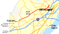
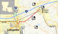
 US 61 190 Business (Baton Rouge) map.svg 1,205 × 709; 1.89 MB
-
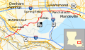
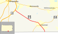
 US 61 Business (St. Francisville) map.svg 1,205 × 709; 487 KB
-
 LA 62 map.svg 1,205 × 709; 361 KB
-
 U.S. Route 62 in Pennsylvania map.svg 1,204 × 708; 544 KB
-
 LA 63 map.svg 1,205 × 709; 898 KB
-
 LA 64 map.svg 1,202 × 707; 2.5 MB
-
 Pennsylvania Route 64 map.svg 1,204 × 708; 236 KB
-
 LA 66 map.svg 1,205 × 709; 701 KB
-
 LA 67 map.svg 1,205 × 709; 767 KB
-
 LA 68 map.svg 1,205 × 709; 431 KB
-
 Pennsylvania Route 68 map.svg 1,204 × 708; 510 KB
-
 LA 69 map.svg 1,205 × 709; 1.36 MB
-
 Pennsylvania Route 69 map.svg 1,204 × 708; 82 KB
-
 Delaware Route 7 map.svg 3,015 × 2,011; 597 KB
-
 VA 7 map.svg 1,205 × 709; 617 KB
-
 OH 7A map.svg 1,006 × 592; 252 KB
-
 LA 70 map.svg 1,205 × 709; 1.23 MB
-
 LA 72 map.svg 1,205 × 709; 675 KB
-
 Pennsylvania Route 72 map.svg 1,204 × 708; 757 KB
-
 LA 73 map.svg 1,205 × 709; 4.6 MB
-
 LA 74 map.svg 1,205 × 709; 353 KB
-
 Pennsylvania Route 74 map.svg 1,204 × 708; 852 KB
-
 LA 75 map.svg 1,205 × 709; 1.91 MB
-
 Pennsylvania Route 75 map.svg 1,204 × 708; 1.15 MB
-
 LA 76 map.svg 1,205 × 709; 1.81 MB
-
 LA 77 map.svg 1,205 × 709; 1.1 MB
-
 Pennsylvania Route 77 map.svg 1,204 × 708; 196 KB
-
 LA 78 map.svg 1,205 × 709; 339 KB
-
 Delaware Route 8 map.svg 3,015 × 2,011; 421 KB
-
 VA 8 map.svg 1,205 × 709; 1.29 MB
-
 LA 81 map.svg 1,205 × 709; 314 KB
-
 LA 82 map.svg 1,205 × 709; 1.33 MB
-
 PA 82 map.svg 1,204 × 708; 351 KB
-
 LA 83 map.svg 1,205 × 709; 1.97 MB
-
 LA 85 map.svg 1,205 × 709; 527 KB
-
 Pennsylvania Route 85 map.svg 1,204 × 708; 117 KB
-
 LA 86 map.svg 1,205 × 709; 1.57 MB
-
 Pennsylvania Route 86 map.svg 1,204 × 708; 147 KB
-
 LA 87 map.svg 1,205 × 709; 2.31 MB
-
 Pennsylvania Route 87 map.svg 1,204 × 708; 257 KB
-
 LA 88 map.svg 1,205 × 709; 441 KB
-
 Pennsylvania Route 88 map.svg 1,204 × 708; 464 KB
-
 LA 89 map.svg 1,205 × 709; 471 KB
-
 Delaware Route 9 map.svg 3,015 × 2,011; 297 KB
-
 OH 9 map.svg 1,006 × 592; 943 KB
-
 VA 9 map.svg 1,205 × 709; 780 KB
-
 Delaware Route 9A map.svg 2,011 × 1,184; 111 KB
-
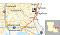
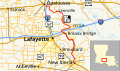
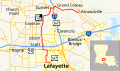
 US 90 Business (Lafayette) map.svg 1,205 × 709; 1.25 MB
-
 US 90 Business (New Orleans) map.svg 1,205 × 709; 4.08 MB
-
 LA 91 map.svg 1,205 × 709; 1.09 MB
-
 LA 92 map.svg 1,205 × 709; 824 KB
-
 Pennsylvania Route 92 map.svg 1,204 × 708; 1.12 MB
-
 LA 93 map.svg 1,205 × 709; 548 KB
-
 Pennsylvania Route 93 map.svg 1,204 × 708; 310 KB
-
 LA 94 map.svg 1,205 × 709; 1.8 MB
-
 Pennsylvania Route 94 map.svg 1,196 × 700; 440 KB
-
 LA 95 map.svg 1,205 × 709; 665 KB
-
 LA 96 map.svg 1,205 × 709; 1.73 MB
-
 LA 97 map.svg 1,205 × 709; 360 KB
-
 Pennsylvania Route 97 (Adams County) map.svg 1,204 × 708; 109 KB
-
 Pennsylvania Route 97 (Erie County) map.svg 1,204 × 708; 248 KB
-
 LA 98 map.svg 1,205 × 709; 568 KB
-
 Pennsylvania Route 98 map.svg 1,204 × 708; 418 KB
-
 LA 99 map.svg 1,205 × 709; 596 KB
-
 Delaware Route 10 map.svg 2,011 × 1,184; 232 KB
-
 NC 10 map.svg 1,204 × 709; 1 MB
-
 VA 10 map.svg 1,205 × 709; 1.21 MB
-
 LA 100 map.svg 1,205 × 709; 291 KB
-
 LA 101 map.svg 1,205 × 709; 1.55 MB
-
 LA 102 map.svg 1,205 × 709; 430 KB
-
 Pennsylvania Route 102 map.svg 1,204 × 708; 121 KB
-
 LA 103 map.svg 1,205 × 709; 493 KB
-
 Pennsylvania Route 103 map.svg 1,204 × 708; 241 KB
-
 LA 104 map.svg 1,205 × 709; 444 KB
-
 Pennsylvania Route 104 map.svg 1,204 × 708; 316 KB
-
 LA 106 map.svg 1,205 × 709; 454 KB
-
 Pennsylvania Route 106 map.svg 1,456 × 856; 137 KB
-
 LA 107 map.svg 1,205 × 709; 851 KB
-
 Pennsylvania Route 107 map.svg 1,204 × 708; 228 KB
-
 LA 108 map.svg 1,205 × 709; 1,011 KB
-
 Pennsylvania Route 108 map.svg 1,204 × 708; 287 KB
-
 LA 109 map.svg 1,205 × 709; 645 KB
-
 Delaware Route 11 map.svg 1,207 × 711; 130 KB
-
 OH 11 map.svg 1,006 × 592; 1.01 MB
-
 LA 110 map.svg 1,205 × 709; 326 KB
-
 Pennsylvania Route 110 map.svg 1,204 × 708; 68 KB
-
 LA 111 map.svg 1,205 × 709; 744 KB
-
 LA 112 map.svg 1,205 × 709; 764 KB
-
 Pennsylvania Route 113 map.svg 1,204 × 708; 600 KB
-
 LA 114 map.svg 1,205 × 709; 324 KB
-
 Pennsylvania Route 114 map.svg 1,204 × 708; 241 KB
-
 LA 116 map.svg 1,205 × 709; 349 KB
-
 Pennsylvania Route 116 map.svg 1,200 × 704; 207 KB
-
 Pennsylvania Route 117 map.svg 1,204 × 708; 93 KB
-
 Pennsylvania Route 118 map.svg 1,204 × 708; 251 KB
-
 Delaware Route 12 map.svg 2,011 × 1,184; 192 KB
-
 OH 12 map.svg 1,006 × 592; 397 KB
-
 Pennsylvania Route 121 map.svg 1,204 × 708; 458 KB
-
 LA 122 map.svg 1,205 × 709; 511 KB
-
 LA 123 map.svg 1,205 × 709; 398 KB
-
 Pennsylvania Route 124 map.svg 1,204 × 708; 136 KB
-
 LA 125 map.svg 1,205 × 709; 248 KB
-
 Pennsylvania Route 125 map.svg 1,204 × 708; 215 KB
-
 LA 126 map.svg 1,205 × 709; 1.01 MB


_2014.svg)


_map.svg)
_map.svg)


_map.svg)
_map.svg)


_map.svg)
_map.svg)


