Category:Maps from The Trolley Wayfinder (1908)
Media in category "Maps from The Trolley Wayfinder (1908)"
The following 31 files are in this category, out of 31 total.
-
 Consolidated System 1908 map.jpg 3,117 × 2,547; 271 KB
-
 Worcester Consolidated Street Railway 1908 map.jpg 1,118 × 1,106; 119 KB
-
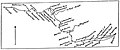
 1908 bird's eye view map of the Boston Elevated Railway.jpg 2,719 × 1,740; 1.16 MB
-
 1908 map of Manchester Street Railway suburban lines.jpg 1,078 × 1,701; 299 KB
-
 1908 map of Newton Street Railway and connecting lines.jpg 2,189 × 1,712; 815 KB
-
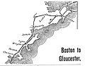 1908 map of street railway lines between Boston and Gloucester.jpg 729 × 572; 116 KB
-
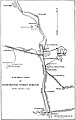
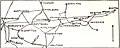
 1908 map of street railway lines between Boston and Haverhill.jpg 324 × 876; 81 KB
-
-
-
 1908 map of street railways around Worcester.jpg 493 × 906; 134 KB
-
 1908 map of street railways between Boston and New Bedford.jpg 333 × 897; 113 KB
-
 1908 map of street railways between Boston and Newport.jpg 359 × 899; 114 KB
-
 1908 map of street railways between Boston and Plymouth.jpg 389 × 447; 84 KB
-

-

-
 1908 map of street railways between Boston and Stoughton.jpg 469 × 898; 155 KB
-
 1908 map of street railways between Boston and Woonsocket.jpg 689 × 523; 75 KB
-
 1908 map of street railways between Worcester and New York City.jpg 365 × 1,540; 190 KB
-
 1908 map of streetcar lines between Boston and the Merrimack Valley.jpg 721 × 871; 134 KB
-
 1908 map of streetcar lines between Boston and Worcester.jpg 901 × 364; 101 KB
-
 1908 map of the Atlantic Shore Line Railway.jpg 1,069 × 1,602; 319 KB
-
 1908 map of the Blue Hill Street Railway and connections.jpg 831 × 1,030; 337 KB
-
 1908 map of the Boston and Northern Street Railway.jpg 2,127 × 1,702; 1.03 MB
-
 1908 map of the Boston and Worcester Street Railway and connections.jpg 1,943 × 1,709; 844 KB
-
 1908 map of the Boston and Worcester Street Railway.jpg 1,378 × 867; 246 KB
-
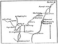
 1908 map of the Brockton and Plymouth Street Railway.jpg 2,094 × 702; 636 KB
-
 1908 map of the New Bedford and Onset Street Railway and connections.jpg 366 × 900; 133 KB
-
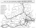
 1908 map of the New Hampshire Electric Railways.jpg 1,578 × 1,711; 722 KB
-
 1908 map of the Newport and Providence Railway.jpg 867 × 1,328; 732 KB
-
 1908 map of the Northern Massachusetts Street Railway.jpg 897 × 307; 66 KB
-
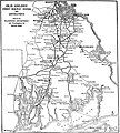 1908 map of the Old Colony Street Railway.jpg 1,530 × 1,696; 859 KB


