Category:Maps from Valentine's Manual
Sorted by year depicted.
Subcategories
This category has only the following subcategory.
1
Media in category "Maps from Valentine's Manual"
The following 65 files are in this category, out of 65 total.
-
 Map of Old Jan's land and the Bogardus farm adjoining, 1645.jpg 2,237 × 3,925; 2.9 MB
-

-

-
 Manual of the corporation of the city of New York (1859) (14783611773).jpg 4,000 × 2,452; 1.73 MB
-
 Map of New York in 1695.jpg 1,425 × 883; 1.71 MB
-
 The Fort in New Yorke.jpg 1,530 × 1,326; 1.02 MB
-

-

-
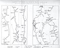
 A survey of the roads of the United States of America LOC 84675230-2.tif 1,653 × 2,341; 11.07 MB
-
 A survey of the roads of the United States of America LOC 84675230-3.jpg 1,774 × 2,420; 595 KB
-
 A survey of the roads of the United States of America LOC 84675230-3.tif 1,774 × 2,420; 12.28 MB
-
 Map, New York to New Rochelle, Christopher Colles and Cornelius Tiebout, 1789.jpg 2,072 × 1,666; 1.91 MB
-
 Taylor map of the City of New York 1797 (cropped) Fly Market.jpg 2,400 × 531; 762 KB
-
 Taylor map of the City of New York 1797 (cropped).jpg 4,526 × 2,722; 17.88 MB
-
 Taylor map of the City of New York 1797.jpg 5,004 × 3,217; 4.38 MB
-

-
 Manual of the corporation of the city of New York, for the years (1862) (14778233455).jpg 3,364 × 2,454; 1.24 MB
-
 Old New York, The Bouwery, from Valentine's Manual 1862.jpg 2,560 × 2,083; 5.57 MB
-
 1807 Bridges Map of New York City (1871 reissue) - Geographicus - NewYork-bridges-1871.jpg 3,000 × 2,934; 2.72 MB
-
 1831 Hooker Map of New York City (1871 reissue) - Geographicus - NewYork-hooker-1871.jpg 3,000 × 3,763; 2.6 MB
-
 Map of the City of New York, high water line, farms and estates (cropped).jpg 1,240 × 1,761; 4.06 MB
-
 Plan of the City of New York, made and swamp land, Valentine's Manual 1856.jpg 1,867 × 2,560; 923 KB
-
 1858 Map of the City and County of New York.jpg 2,088 × 2,560; 1.63 MB
-
-
 1865 Dripps Map of New York City - Geographicus - NewYork-dripps-1865.jpg 3,076 × 5,000; 3.96 MB
-

-

-
 Map of the City of New York, Political Divisions and Subdivisions, 1870.jpg 8,381 × 3,213; 4.9 MB
-
 1871 Hardy Map of New York City Fire Departments - Geographicus - NewYorkFire-hardy-1871.jpg 3,500 × 3,057; 2.59 MB
-

-

-

-
 A survey of the roads of the United States of America LOC 84675230-2.jpg 1,653 × 2,341; 559 KB
-
 Chart of New York Harbour and its Defences 1781.jpg 1,961 × 3,383; 3.66 MB
-
 Five maps of Manhattan 1870 (left half).jpg 3,510 × 3,021; 3.51 MB
-
 Five maps of Manhattan 1870 (right half).jpg 3,510 × 3,021; 3.03 MB
-
 Historical North America 1621 (cropped).jpg 2,390 × 1,833; 5.37 MB
-
 Historical North America 1621.jpg 2,560 × 1,994; 5.89 MB
-
 Manual of the corporation of the city of New York (1857) (14740706326).jpg 3,856 × 3,112; 1.51 MB
-
 Manual of the corporation of the city of New York (1857) (14760594861).jpg 1,384 × 3,292; 456 KB
-
 Manual of the corporation of the city of New York (1857) (14761435964).jpg 1,776 × 3,434; 881 KB
-
 Manual of the corporation of the city of New York (1857) (14763440612).jpg 3,436 × 2,364; 1.03 MB
-
 Manual of the corporation of the city of New York (1857) (14783656323).jpg 3,608 × 2,780; 1.26 MB
-
 Manual of the corporation of the city of New York (1859) (14576955110).jpg 1,852 × 3,032; 1.66 MB
-
 Manual of the corporation of the city of New York (1859) (14577022838).jpg 3,284 × 1,728; 1.57 MB
-
 Manual of the corporation of the city of New York (1859) (14763656835).jpg 1,872 × 3,200; 1.53 MB
-

-
 Manual of the corporation of the city of New York, for the years (1842) (14769472062).jpg 3,591 × 2,748; 1.68 MB
-

-

-
 Manual of the corporation of the city of New York, for the years (1849) (14750430866).jpg 3,484 × 2,546; 1.41 MB
-

-
 Map of British Military Operations in New York and New Jersey in 1776 (6 MB).jpg 1,846 × 2,559; 5.27 MB
-
 Map of British Military Operations in New York and New Jersey in 1776 (73 MB).jpg 7,510 × 10,412; 69.28 MB
-
 Map of Brooklyn and Lower Manhattan in September 1776 (34 MB).jpg 8,663 × 6,154; 32.79 MB
-
 Map of Brooklyn and Lower Manhattan in September 1776 (4 MB).jpg 2,559 × 1,818; 3.48 MB
-
 Map of New York City with fire and watch districts 1841.jpg 4,231 × 3,038; 15.58 MB
-
 Map of New York City, high water line, farms and estates (cropped).jpg 1,573 × 2,256; 5.75 MB
-
 Map of New York City, high water line, farms and estates.jpg 1,804 × 2,560; 1.38 MB
-
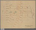
 Map of New York County showing wards and police precincts, 1870.jpg 3,218 × 2,656; 8.83 MB
-
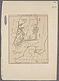
 Map of New York State, Census of 1850, Valentine's Manual 1851.jpg 2,559 × 2,008; 5.49 MB
-
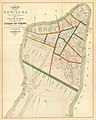
 Map of the City and County of New York 1860.jpg 2,018 × 2,559; 5.97 MB
-
 Map of the City and County of New York 1861.jpg 2,090 × 2,559; 6.44 MB
-
 Map of the City of New York, high water line, farms and estates.jpg 1,676 × 2,560; 4.25 MB
-
 Two maps of the City of New York; Wards, School Districts, and Justice Districts; 1870.jpg 6,444 × 4,798; 29.81 MB

.jpg)
_(14783611773).jpg)


_-_Geographicus_-_NYCHarlemHeights3-rogers-1868.jpg)


.jpg)

_(14755226126).jpg)
_(14778233455).jpg)

_-_Geographicus_-_NewYork-bridges-1871.jpg)
_-_Geographicus_-_NewYork-hooker-1871.jpg)
.jpg)


_(14754611326).jpg)
_(14775251284).jpg)


.jpg)
.jpg)
.jpg)

_(14740706326).jpg)
_(14760594861).jpg)
_(14761435964).jpg)
_(14763440612).jpg)
_(14783656323).jpg)
_(14576955110).jpg)
_(14577022838).jpg)
_(14763656835).jpg)
_(14583157319).jpg)
_(14769472062).jpg)
_(14789759413).jpg)
_(14586948757).jpg)
_(14750430866).jpg)
_(14773421125).jpg)
.jpg)
.jpg)
.jpg)
.jpg)

.jpg)


_Fly_Market.jpg)
_-_Geographicus_-_NewYork-shannon-1868.jpg)