Category:Maps in the Wellcome Collection
Media in category "Maps in the Wellcome Collection"
The following 200 files are in this category, out of 257 total.
(previous page) (next page)-
 16th Century map of Asia Wellcome L0044808.jpg 3,510 × 2,646; 3.93 MB
-
 16th Century map of Persia Wellcome L0044811.jpg 3,614 × 2,660; 3.54 MB
-
 A general map of Eastern and Western Tartery Wellcome L0011547.jpg 1,660 × 1,182; 1.18 MB
-
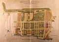 A general plan of the layout of the Royal Naval Hospital, Gr Wellcome V0013338.jpg 3,100 × 2,211; 3.23 MB
-
 A general plan of the layout of the Royal Naval Hospital, Gr Wellcome V0013339.jpg 3,100 × 2,223; 3.12 MB
-
 A guardroom; an officer holds up a map to show to a man smok Wellcome V0040553.jpg 3,016 × 2,520; 4.29 MB
-
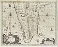 A map of India, showing Malabar, Madura and Cormeddel Wellcome L0038175.jpg 3,888 × 3,120; 3.34 MB
-
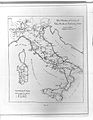
 A map of Italy Wellcome V0049914.jpg 3,434 × 2,388; 4.01 MB
-
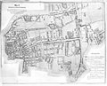
 A map of London; showing sites of medical interest in Lambet Wellcome V0012880.jpg 3,332 × 2,440; 4.12 MB
-
 A Map of the route of the Emin Pasha Relief Expedition Wellcome L0034226.jpg 7,770 × 4,512; 17.79 MB
-
 A Map of the routes of The Emin Pasha Relief Expedition Wellcome L0034371.jpg 7,046 × 5,282; 22.6 MB
-
 A map of the world showing the voyages of La Pérouse Wellcome V0049923.jpg 3,699 × 2,196; 2.32 MB
-
 A map showing the caves and valleys of denudation in the dis Wellcome V0023180.jpg 2,541 × 3,309; 2.97 MB
-
 A map taken from a report by Dr. John Snow Wellcome L0072917.jpg 4,757 × 4,418; 3.74 MB
-
 A plan delineating Defoe's circuit. Wellcome L0005007.jpg 1,666 × 1,178; 1.02 MB
-
 A plan of ancinet Cuzco, Peru Wellcome L0042062.jpg 3,936 × 2,440; 2.63 MB
-
 A plan of the city of Pellacata with its Castle Wellcome L0038176.jpg 3,966 × 3,120; 5.2 MB
-
 A plan of the Convent and church of Santo Domingo, Cuzco Wellcome L0042061.jpg 3,872 × 2,600; 2.14 MB
-
 A town plan of the trading port Batavia Wellcome L0038151.jpg 3,888 × 3,156; 3.59 MB
-
 A. De Humboldt, Atlas geographique Wellcome L0022471.jpg 1,505 × 1,261; 1.14 MB
-
 A. W. Blyth; A dictionary of hygiene... Wellcome L0030938.jpg 1,638 × 1,258; 928 KB
-
 Actual & supposed routes of Cholera from Hindoostan to Europe Wellcome L0041104.jpg 4,008 × 2,672; 2.54 MB
-
 Actual & supposed routes of Cholera from Hindoostan to Europe Wellcome L0074539.jpg 5,802 × 4,145; 6.63 MB
-
 Ancient provinces, France and departments that replaced them. Wellcome M0016661.jpg 3,780 × 2,992; 2.26 MB
-
 Angelo Celli, Malaria according to the new researches Wellcome L0026233.jpg 1,255 × 1,624; 728 KB
-
 Arca Noe, geography of world after flood, by A. Kircher. Wellcome L0013366.jpg 1,617 × 1,157; 897 KB
-
 Archaeological map of Caddington and Dunstable district. Wellcome M0015598.jpg 3,750 × 2,929; 4.58 MB
-
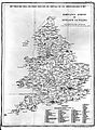
 Areas where Apothecaries were to be found. Wellcome L0004945.jpg 1,410 × 1,446; 220 KB
-
 Astronomy explained upon Sir Isaac Newton's principles Wellcome L0069635.jpg 6,200 × 3,483; 6.03 MB
-
 Cancer in England and Wales 1919-1923. Wellcome L0005800.jpg 1,250 × 1,544; 756 KB
-
 Cavendish Square and environs, 1764.jpg 309 × 333; 455 KB
-
 Chadwick's Bethnal Green Parish map. Wellcome L0009782.jpg 3,572 × 2,892; 4.15 MB
-
 Chadwick's sanitary map of Leeds. Wellcome L0009781.jpg 3,804 × 2,580; 2.68 MB
-
 Charles Booth, Life and labour in the people of London Wellcome L0027749.jpg 1,518 × 1,292; 1.27 MB
-
 Charles Booth, Life and labour of the people in London Wellcome L0027742.jpg 3,544 × 3,121; 5.48 MB
-
 Charles Booth, Life and labour of the people in London Wellcome L0027750.jpg 1,510 × 1,282; 1.19 MB
-
 Charles Booth, Life and labour of the people in London Wellcome L0029443.jpg 2,510 × 4,464; 5.43 MB
-
 Charles Booth, Life and labour of the people Wellcome L0027741.jpg 1,508 × 1,266; 1.28 MB
-
 Charles Booth, Life and labour of the people Wellcome L0029442.jpg 3,622 × 3,102; 5.77 MB
-
 Civil engineering; a plan to improve the silted-up harbour a Wellcome V0024378.jpg 2,102 × 3,321; 2.57 MB
-
 Civilization and Climate, world map Wellcome L0029476.jpg 1,676 × 1,224; 944 KB
-
 DELEPINE; Investigations in the Public Healt Wellcome L0032434.jpg 4,391 × 4,192; 7.29 MB
-
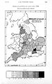
 Density of population in Great Britain in 1841. Wellcome L0005187.jpg 1,031 × 1,887; 359 KB
-
 Descriptive map of London poverty, 1889 Wellcome L0027751.jpg 5,035 × 3,727; 10.36 MB
-
 Descriptive map of London poverty, 1889 Wellcome L0074435.jpg 8,114 × 5,978; 17.48 MB
-
 Descriptive map of London poverty, 1889 Wellcome L0074436.jpg 6,320 × 5,732; 13.59 MB
-
 Descriptive map of London poverty, 1889 Wellcome L0074437.jpg 6,256 × 5,700; 12.71 MB
-
 Descriptive map of London poverty, 1889. Wellcome L0074439.jpg 6,272 × 5,748; 13 MB
-
 Detail of plate 11 showing Cambalu Wellcome L0071619.jpg 4,000 × 4,173; 3.8 MB
-
 Detail of plate 11 showing Magnus Chan Wellcome L0071618.jpg 4,680 × 4,044; 5.55 MB
-
 Detail of plate showing Porlok and Minhed Wellcome L0071620.jpg 3,600 × 4,500; 4.32 MB
-
 Ecclesiastical divisions, France 1905. Wellcome M0016660.jpg 3,661 × 3,034; 2.64 MB
-
 Estate records for Ticehurst Hospital Wellcome L0021189.jpg 4,336 × 3,639; 3.67 MB
-
 Estate records for Ticehurst Hospital Wellcome L0021190.jpg 1,260 × 1,490; 1.08 MB
-
 G. M. Wheeler, Geological atlas Wellcome L0027638.jpg 1,593 × 1,272; 993 KB
-
 G. M. Wheeler, Geological atlas Wellcome L0027639.jpg 1,433 × 1,324; 998 KB
-
 Geographical Distribution of Tropical Diseas Wellcome L0029475.jpg 1,626 × 1,286; 1.01 MB
-
 Geological map of Maidenhead district Wellcome M0016957.jpg 2,792 × 3,924; 4.89 MB
-
 German map showing the path of cholera in Poland, 1831. Wellcome L0076254.jpg 6,385 × 5,848; 12.68 MB
-
 Guillaume Thomas Francois Raynal. Wellcome L0002250.jpg 1,166 × 1,688; 848 KB
-
 Guillaume Thomas Francois Raynal. Wellcome L0002251.jpg 1,176 × 1,750; 934 KB
-
 H. Burdett, Hospitals and asylums of the wor Wellcome L0029692.jpg 1,204 × 1,840; 755 KB
-
 H. Chauncy, The historical antiquities of of Hertfordshire Wellcome L0020612.jpg 1,550 × 1,186; 1.2 MB
-
 H. Sloane, A voyage to the islands Madera, B Wellcome L0031393.jpg 1,528 × 1,440; 1.28 MB
-
 Hand-drawn map showing settlements in Belgian Congo Wellcome L0039133.jpg 3,966 × 3,186; 3.79 MB
-
 Henry M. Stanley, In darkest Africa Wellcome L0027738.jpg 1,690 × 1,116; 909 KB
-
 Histoire de la Société royale de médecine année 1776-1789 Wellcome L0068469.jpg 4,800 × 3,734; 2.76 MB
-
 Islamic map of the world Wellcome L0035009.jpg 3,576 × 4,072; 2.54 MB
-
 Island of Deshima, Dutch East India Company Wellcome L0035084.jpg 3,929 × 1,608; 1.37 MB
-
 J. Kennedy, The History of the contagious Wellcome M0012982.jpg 3,756 × 2,826; 1.83 MB
-
 Key Plan to Guy's Hospital Wellcome L0034562.jpg 3,624 × 2,632; 1.65 MB
-
 A map showing the Islands off Batavia (Jakarta) Wellcome L0038170.jpg 3,990 × 3,126; 2.84 MB
-
 Map charting the voyage of H.M.S. Beagle Wellcome L0051046.jpg 6,470 × 3,135; 2.33 MB
-
 Malaria in England Wellcome L0024500.jpg 1,260 × 1,732; 926 KB
-
 Map Exhibiting the Progress of the Late Epidemic Cholera... Wellcome L0071628.jpg 6,160 × 4,654; 5.43 MB
-
 Map from "Letters and notes on the manners..." Vol II Wellcome L0073493.jpg 3,471 × 5,400; 4.98 MB
-
 Map from the Ninevah expedition by Sir Henry Layards Wellcome M0004421.jpg 2,986 × 3,735; 1.34 MB
-
 Map indicating public and private Sanatoria and Hospitals Wellcome L0001501.jpg 1,182 × 1,580; 812 KB
-
 Map of "Ediniae" Wellcome L0021913.jpg 1,110 × 1,732; 971 KB
-
 Map of 'S Gravenhage. Wellcome L0009566.jpg 1,610 × 1,238; 834 KB
-
 Map of 'South African Republic' Wellcome L0021298.jpg 1,538 × 1,248; 1.02 MB
-
 Map of 16th century Caribbean. Wellcome L0001228.jpg 1,734 × 1,186; 496 KB
-
 Map of Africa marked with cattle areas. Wellcome M0018127.jpg 3,176 × 3,520; 529 KB
-
 Map of Antilles and Windward Isles. Wellcome L0002630EC.jpg 1,130 × 1,686; 1 MB
-
 Map of Antilles Isles. Wellcome L0002630EA.jpg 1,617 × 1,092; 959 KB
-
 Map of Arabia, in Olfert Dapper Wellcome L0011010.jpg 1,482 × 1,290; 984 KB
-
 Map of area around Kalhutti, R. Ross. Wellcome L0027602.jpg 1,120 × 1,637; 682 KB
-
 Map of Assyria from the Ninevah expedition by Sir Layards Wellcome M0004422.jpg 2,928 × 3,774; 1.39 MB
-
 Map of Bethel Hospital, Norwich 1906 Wellcome L0034820.jpg 4,008 × 3,424; 1.95 MB
-
 Map of Bilston. Wellcome L0009563.jpg 1,830 × 1,104; 476 KB
-
 Map of Britain in 626 A.D. Wellcome M0008071.jpg 2,616 × 4,061; 2.76 MB
-
 Map of Britannia Wellcome L0051170.jpg 4,464 × 6,626; 11.19 MB
-
 Map of Chiloe Wellcome L0051063.jpg 4,584 × 6,468; 5.03 MB
-
 Map of Cincinnati Wellcome L0040478.jpg 3,954 × 2,284; 3.67 MB
-
 Map of Circassia Wellcome L0040021.jpg 3,763 × 1,789; 1.73 MB
-
 Map of Crimea. Wellcome L0004279.jpg 1,762 × 1,074; 1,015 KB
-
 Map of Dominica Isle. Wellcome L0002630EB.jpg 1,620 × 1,106; 836 KB
-
 Map of Emin Pasha's Province Wellcome L0034859.jpg 3,600 × 3,744; 2.66 MB
-
 Map of England & Wales showing population in 1750. Wellcome M0000914.jpg 1,006 × 1,679; 482 KB
-
 Map of England & Wales showing population in 1801. Wellcome M0000913.jpg 1,011 × 1,662; 545 KB
-
 Map of England & Wales showing population, 1700s. Wellcome M0000912.jpg 1,025 × 1,646; 422 KB
-
 Map of England and Wales Wellcome V0049911.jpg 2,494 × 2,815; 3.25 MB
-
 Map of England showing prevalence of cholera, 1849 Wellcome L0039174.jpg 3,760 × 4,653; 9.8 MB
-
 Map of Exeter, Great Britain. Wellcome L0009564.jpg 1,478 × 1,368; 739 KB
-
 Map of France showing soil relief. Wellcome M0015461.jpg 2,906 × 3,638; 3.26 MB
-
 Map of France Wellcome V0049915.jpg 3,033 × 2,497; 3.69 MB
-
 Map of French Guiana. Wellcome L0002631EC.jpg 1,150 × 1,670; 889 KB
-
 Map of Hudson River Line Steamers Wellcome L0046613.jpg 2,468 × 3,908; 3.48 MB
-
 Map of Huoqing zhou, in Lijiang Prefecture, Yunnan Provonce Wellcome L0031302.jpg 3,664 × 3,028; 4.23 MB
-
 Map of India, showing the chinchona plantations Wellcome L0025460.jpg 1,282 × 1,437; 717 KB
-
 Map of London and Westminster before the Fire of London. Wellcome M0012069.jpg 4,728 × 2,262; 2.44 MB
-
 Map of Lycia by Charles Fellows Wellcome L0022188.jpg 1,686 × 1,100; 1.14 MB
-
 Map of Metlakahtla, Annette Island Wellcome M0013150.jpg 3,814 × 2,836; 2.11 MB
-
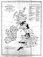 Map of mining districts of the U.K. 1842 Wellcome L0008343.jpg 1,194 × 1,584; 680 KB
-
 Map of Mr Ives's journey Wellcome L0046622.jpg 3,516 × 2,632; 1.59 MB
-
 Map of New Orleans Wellcome L0040476.jpg 2,432 × 3,944; 3.85 MB
-
 Map of Newcastle. Wellcome L0009568.jpg 1,598 × 1,330; 221 KB
-
 Map of Nikko, Japan and its surrounding vicinity Wellcome L0041423.jpg 3,856 × 2,660; 2.15 MB
-
 Map of Northern Africa with a picture of African people Wellcome V0049910.jpg 4,061 × 1,813; 2.7 MB
-
 Map of Oceania and Pacific Ocean. Wellcome M0005004.jpg 3,708 × 2,839; 2.8 MB
-
 Map of Oxford and surroundings; Thomas Willis Wellcome L0011741.jpg 1,494 × 1,300; 796 KB
-
 Map of Oxford; Thomas Willis Wellcome L0011739.jpg 1,620 × 1,272; 692 KB
-
 Map of Padua Wellcome L0046157.jpg 2,644 × 3,772; 2.07 MB
-
 Map of Paris, 1855 Wellcome L0013020.jpg 1,490 × 1,232; 924 KB
-
 Map of part of Tierra del Fuego Wellcome L0051065.jpg 6,728 × 4,590; 5.09 MB
-
 Map of Pontine marshes, from Lancisi, De noxiis..., 1717 Wellcome L0017845.jpg 1,941 × 978; 956 KB
-
 Map of principal Mesolithic sites in Britain. Wellcome M0016326.jpg 2,598 × 4,120; 1,015 KB
-
 Map of Russia lent by Dr. Schuster. Wellcome L0004274.jpg 1,238 × 1,512; 812 KB
-
 Map of Scheveningen Wellcome L0009565.jpg 1,175 × 1,529; 717 KB
-
 Map of Scotland Wellcome L0048593.jpg 3,648 × 4,062; 3.54 MB
-
 Map of Scotland Wellcome V0049912.jpg 2,439 × 2,945; 3.66 MB
-
 Map of Scotland, with rites in archaeology. Wellcome M0002544.jpg 1,345 × 1,583; 302 KB
-
 Map of Soho showing deaths from Cholera, 1854. Wellcome L0003055.jpg 3,047 × 3,426; 4.7 MB
-
 Map of South Africa with a picture of the Cape of Good Hope Wellcome V0049909.jpg 3,071 × 2,309; 2.95 MB
-
 Map of South Africa, showing sites of Bushman drawings. Wellcome M0015200.jpg 3,039 × 3,925; 2.44 MB
-
 Map of South America Wellcome L0051066.jpg 4,944 × 5,852; 8.06 MB
-
 Map of Southern portion of South America Wellcome L0051077.jpg 5,314 × 4,926; 4.35 MB
-
 Map of Spain and Portugal Wellcome V0049916.jpg 2,929 × 2,384; 2.89 MB
-
 Map of St Louis Wellcome L0040477.jpg 2,296 × 3,948; 3.23 MB
-
 Map of St. Albans, Great Britain. Wellcome L0009748.jpg 1,230 × 1,660; 936 KB
-
 Map of St. Pancras in 1833 showing Parish Boundaries. Wellcome M0012504.jpg 2,303 × 4,579; 3.04 MB
-
 Map of Sweden Wellcome V0049917.jpg 3,000 × 2,329; 2.76 MB
-
 Map of the Cape of Good Hope, South Africa. Wellcome L0037786.jpg 4,026 × 3,240; 3.48 MB
-
 Map of the central portion of the City of London Wellcome L0005006.jpg 1,640 × 1,228; 948 KB
-
 Map of the city of London. Wellcome M0012961.jpg 3,879 × 2,792; 2.89 MB
-
 Map of the garden Altdorffinus. Wellcome L0007765.jpg 1,682 × 1,126; 708 KB
-
 Map of the Indian Empire. Wellcome M0001254.jpg 1,519 × 1,264; 746 KB
-
 Map of the island of Ascension Wellcome L0051078.jpg 6,266 × 4,836; 7.23 MB
-
 Map of the island of Ceylon Wellcome L0047915.jpg 3,090 × 4,912; 4.32 MB
-
 Map of the low islands Wellcome L0051062.jpg 6,438 × 4,428; 4.25 MB
-
 Map of the New World Wellcome L0064140.jpg 6,558 × 4,912; 10.55 MB
-
 Map of the Parish of Bethnal Green, Shewing the Cholera Mist Wellcome L0071632.jpg 5,765 × 3,856; 5.32 MB
-
 Map of the Roman Empire in the time of Galen. Wellcome M0000910.jpg 1,583 × 1,070; 641 KB
-
 Map of the strait of Magellan. Wellcome L0051064.jpg 6,410 × 4,500; 5.27 MB
-
 Map of the vale of the Evenlode, Thames, charting stone form Wellcome V0023165.jpg 2,641 × 3,551; 3.19 MB
-
 Map of the voyages of Columbus and Cabot Wellcome M0007960.jpg 3,402 × 3,103; 2.5 MB
-
 Map of the world according to Herodotus. Wellcome M0000909.jpg 1,613 × 1,042; 465 KB
-
 Map of the world in outline, with pacific in centre. Wellcome M0008940.jpg 3,638 × 2,893; 1.61 MB
-
 Map of the world showing distribution of "Primitive Peoples". Wellcome M0012296.jpg 3,784 × 2,996; 1.77 MB
-
 Map of the world showing malaria and blackwater fever. Wellcome M0001541.jpg 4,594 × 2,295; 2.24 MB
-
 Map of the world, showing positions of malaria. Wellcome M0001540.jpg 2,062 × 1,037; 614 KB
-
 Map of the world. Wellcome L0051173.jpg 6,557 × 5,060; 12.44 MB
-
 Map of the world. Wellcome M0005003.jpg 3,767 × 2,838; 2.92 MB
-
 Map of Venice Wellcome L0064135.jpg 6,666 × 4,992; 10.35 MB
-
 Map of Venice Wellcome L0064138.jpg 6,666 × 4,992; 11.7 MB
-
 Map of Westminster. Wellcome M0012962.jpg 4,087 × 2,628; 3.33 MB
-

-
 Map showing deaths from Cholera in Broad Street... Wellcome L0063431.jpg 5,064 × 4,856; 4.92 MB
-
 Map showing ecclesiastical sites in Loch Lomond. Wellcome M0016013.jpg 2,575 × 4,107; 1.7 MB
-
 Map showing eye colour of schoolchildren, Germany 1875 Wellcome L0072219.jpg 4,914 × 4,258; 5.78 MB
-
 Map showing Indian localities in North America, 1833 Wellcome L0050836.jpg 6,472 × 4,012; 6 MB
-
 Map showing position of Barber's Hall. Wellcome L0001243.jpg 1,114 × 1,718; 1.11 MB
-
 Map showing Races in Hellenic times, 1000-800 B.C. Wellcome M0015607.jpg 3,091 × 3,408; 2.04 MB
-
 Map showing situations of skulls found in Europe. Wellcome M0001197.jpg 1,535 × 1,222; 293 KB
-
 Map showing the Cephalic Index of Europe Wellcome L0072218.jpg 4,835 × 4,347; 5.58 MB
-
 Map showing the distribution of Leprosy in India Wellcome L0039112.jpg 4,200 × 4,208; 11.9 MB
-
 Map showing the distribution of Leprosy in India Wellcome L0039113.jpg 4,200 × 4,169; 11.75 MB
-
 Map showing the distribution of Leprosy in India Wellcome L0039114.jpg 4,220 × 4,157; 13.09 MB
-
 Map showing the distribution of Leprosy in India Wellcome L0039115.jpg 4,200 × 4,206; 10.6 MB
-
 Map showing the distribution of the races in Biblical times Wellcome M0013925.jpg 3,602 × 2,945; 3.03 MB
-
 Map showing the harbours of Port Royal and Kingston, Jamaica Wellcome L0063041.jpg 6,102 × 4,976; 9.19 MB
-
 Map showing the intimate mixture of the water supply... Wellcome L0063432.jpg 6,004 × 4,896; 8.97 MB
-
 Map showing the Moslem EMpire - 750 AD. Wellcome M0011931.jpg 4,311 × 2,439; 2.82 MB
-
 Map showing the route of cholera infection through Asia Wellcome L0074533.jpg 5,084 × 3,316; 4.45 MB
-
 Map showing the route of Dr. Livingstone's journey across Africa Wellcome L0038341.jpg 5,865 × 3,032; 5.49 MB
-
 Map showing various reasons for conscript exempton 1831-49 Wellcome L0072278.jpg 7,135 × 5,736; 8.33 MB
-
 Map, water services, Wellcome Veterinary Research Station Wellcome L0038247.jpg 21,261 × 13,033; 73.81 MB
-
 Map; incidence of pellagra in Brescia. Wellcome M0020122.jpg 2,750 × 3,912; 2.05 MB
-
 Map; incidence of pellagra in Northwest Italy. Wellcome M0020120.jpg 3,800 × 2,909; 3.16 MB
-
 Map; incidence of pellagra in Northwest Italy. Wellcome M0020121.jpg 2,658 × 4,004; 2.09 MB
-
 Map; incidence of pellagra in Pavia province, Italy. Wellcome M0020119.jpg 3,050 × 3,570; 2.26 MB
-
 Map; incidence of pellagra in Romania. Wellcome M0020126.jpg 2,800 × 4,015; 2.52 MB
-
 Map; incidence of pellagra in Romania. Wellcome M0020128.jpg 2,802 × 3,816; 2.11 MB
-
 Map; incidence of pellagra in S. Tirol. Wellcome M0020123EB.jpg 3,650 × 2,933; 1.65 MB
-
 Maps of the French countryside with railway lines and trains Wellcome V0041105.jpg 2,994 × 2,333; 3.2 MB
-
 Maps showing the Bristol area. Wellcome M0015006.jpg 2,858 × 3,678; 1.28 MB
-
 Medical Repository, 1798. V. Seaman; yellow fever Wellcome L0021250.jpg 1,550 × 1,238; 1.19 MB
-
 MS 6740, Map of Sussex (East) with Ticehurst Wellcome L0032049.jpg 2,740 × 4,127; 4.28 MB
-
 MS 6786, Ticehurst, Sussex; Vineyard, Asylum Wellcome L0032046.jpg 2,054 × 1,022; 830 KB
-
 Occupational death rates; 1890-1912 Wellcome M0003426.jpg 3,523 × 2,971; 2.34 MB


_Wellcome_L0038170.jpg)


_with_Ticehurst_Wellcome_L0032049.jpg)

