Category:Maps of 10th-century England
Constituent countries of the United Kingdom: England
Media in category "Maps of 10th-century England"
The following 12 files are in this category, out of 12 total.
-

-

-
 England i början av 900-talet.jpg 1,089 × 1,292; 458 KB
-
 Itinerary of Æthelstan-fr.svg 898 × 410; 1.33 MB
-
 Map Edward the Martyr-fr.svg 929 × 793; 1.32 MB
-
 Map of England under Æthelstan-fr.svg 960 × 1,304; 1.33 MB
-
 Map of Wessex in 900.png 723 × 899; 67 KB
-
 Map of Wessex in 945.png 988 × 1,229; 115 KB
-
 Owain ap Dyfnwal (map).png 1,398 × 1,646; 455 KB
-
 Threefold division of England circa 1115.jpg 640 × 663; 65 KB
-
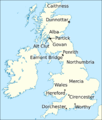
 Æthelflæd Midlands map-nl.svg 345 × 296; 907 KB
-
 Æthelflæd Midlands map.svg 345 × 296; 846 KB
_..._Med_253_Illustrationer_i_Tr%C3%A6snit%27_(11075455993).jpg)
.jpg)


.png)


