Category:Maps of 12th-century Serbia
Countries of Europe: Bulgaria · France‡ · Germany · Greece · Italy · Portugal‡ · Serbia · Spain‡
‡: partly located in Europe
‡: partly located in Europe
| Preceded by: Maps of 11th-century Serbia |
Maps of 12th-century Serbia 1101 AD-1200 AD |
Succeeded by: Maps of 13th-century Serbia |
Subcategories
This category has only the following subcategory.
M
Media in category "Maps of 12th-century Serbia"
The following 23 files are in this category, out of 23 total.
-
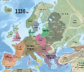 1130 CE, Europe.svg 512 × 438; 1.77 MB
-
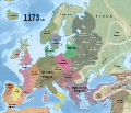 1173 CE, Europe.svg 512 × 438; 1.77 MB
-
 4KKOMNENOS.png 3,840 × 2,160; 507 KB
-

-
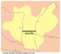
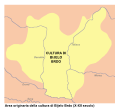 Bijelo Brdo Culture-it.svg 760 × 684; 92 KB
-
 Bijelo brdo culture01.png 1,048 × 937; 47 KB
-
 Bijelo brdo culture02.png 1,048 × 937; 47 KB
-
 Bogomilist expansion-es.svg 792 × 528; 250 KB
-
 Bogomilist expansion.svg 792 × 528; 492 KB
-
 Byzantinisches Reich BV042750970.jpg 2,720 × 3,358; 1.89 MB
-
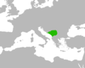
 Duklja map.jpg 607 × 848; 90 KB
-
 Europe 1142.jpg 1,327 × 959; 536 KB
-
 Karta orienten 1190.jpg 1,642 × 942; 583 KB
-
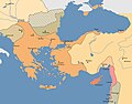 Map of the Byzantine Empire during the Third Crusade.jpg 1,706 × 1,336; 270 KB
-
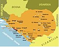
 Map of the Principality of Serbia, 12th century.png 500 × 400; 34 KB
-
 Osvajanja Stefana Nemanje (1183-1187).png 1,500 × 1,336; 410 KB
-
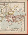
 Public Schools Historical Atlas - Europe 1135.jpg 2,234 × 1,734; 1,013 KB
-
 South-eastern Europe c. 1180.jpg 2,046 × 1,612; 1.87 MB
-
 Srbija Stefana Nemanje.jpg 1,069 × 865; 167 KB
-
 Srbsko XII es.svg 2,415 × 2,000; 594 KB
-
 Stefan Nemanja bild.png 810 × 900; 210 KB
-
 Освајања Стефана Немање.png 1,500 × 1,336; 410 KB
-
 Српске државе половином 12.png 853 × 677; 135 KB


_(14783489772).jpg)


.png)


