Category:Maps of 18th-century Germany
| Preceded by: Maps of 17th-century Germany |
Maps of 18th-century Germany 1701 AD-1800 AD |
Succeeded by: Maps of 19th-century Germany |
Subcategories
This category has only the following subcategory.
M
- Maps of 18th-century Prussia (12 F)
Media in category "Maps of 18th-century Germany"
The following 10 files are in this category, out of 10 total.
-
 Spruner-Menke Handatlas 1880 Karte 47.jpg 3,444 × 2,939; 4.97 MB
-
 Das Rhein-Main-Gebiet vor 150 Jahren (1787).jpg 3,856 × 4,687; 7.09 MB
-
 The Rhineland circa 1789.jpg 516 × 1,522; 443 KB
-
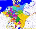 Deutschland 1791.jpg 7,852 × 6,424; 12 MB
-
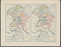 Historical atlas of modern Europe 1903 (135895395).jpg 9,049 × 7,067; 61.72 MB
-
 Historical atlas of modern Europe 1903 (135895436).jpg 9,167 × 6,903; 67.28 MB
-
 Napoleonic Central Europe.jpg 3,937 × 2,855; 2.85 MB
-
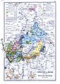 Kurhessen und Nassau.jpg 1,963 × 2,758; 1.72 MB
-
 426 of 'England under Stuart Rule, etc' (11247657373).jpg 1,904 × 1,267; 455 KB
-
 Deutschland im XVIII. Jahrhundert.jpg 5,831 × 4,596; 3.83 MB

.jpg)

.jpg)
.jpg)


.jpg)
