Category:Maps of 19th-century Prussia
Non-contemporary maps showing historical territories of Prussia in the 19th century
Media in category "Maps of 19th-century Prussia"
The following 23 files are in this category, out of 23 total.
-
 (Putzger) Prussia, 1415-1806.jpg 4,072 × 3,118; 2.27 MB
-
 (Putzger) Prussia, 1806-1918.jpg 3,699 × 3,111; 2.12 MB
-

-
 Meyers b13 s0363a.jpg 2,048 × 1,754; 773 KB
-
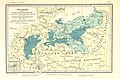
 Preußen 1688 1806 1815 1866.jpg 1,479 × 1,175; 466 KB
-
 Preussen-1806.jpg 1,000 × 502; 187 KB
-
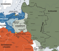
 Preussens Abtretungen.jpg 1,606 × 1,309; 2.17 MB
-
 Image taken from page 253 of 'Die Hohenzollern und das Reich, etc' (11171340484).jpg 1,701 × 2,545; 1.27 MB
-
 315 of 'Die Hohenzollern und das Reich, etc' (11168187784).jpg 2,544 × 1,701; 1.15 MB
-
 Preussen 1807-13.jpg 2,313 × 1,521; 1.4 MB
-

-
 21 of 'Die Hohenzollern und das Reich, etc' (11166831956).jpg 2,528 × 1,654; 1.21 MB
-
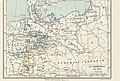
 Die Neubildung des preussischen Staat.jpg 4,534 × 2,864; 4.4 MB
-
 Congress Poland in 1815.PNG 2,295 × 2,275; 324 KB
-
 Flag map of The Kingdom of Prussia (1875-1806).png 510 × 357; 66 KB
-
 Karte kongresspolen.png 896 × 766; 602 KB
-
 Map Germany in 1815 1928-1940 - Touring Club Italiano CART-TRC-57 01.jpg 4,161 × 3,281; 1.68 MB
-
 Map Germany in 1870 1928-1940 - Touring Club Italiano CART-TRC-57 02.jpg 4,507 × 3,040; 1.75 MB
-
 Modern history; Europe (1904) (14742824516).jpg 3,056 × 1,780; 2.03 MB
-
 Modern history; Europe (1904) (14765514552).jpg 1,984 × 1,268; 596 KB
-
 NB 1866-1871.99.svg 971 × 899; 1.88 MB
-
 Norddeutscher Bund.png 777 × 719; 322 KB
-

_Prussia,_1415-1806.jpg)
_Prussia,_1806-1918.jpg)
.jpg)


.jpg)
.jpg)

%27_(11089182076).jpg)
.jpg)


.png)


_(14742824516).jpg)
_(14765514552).jpg)


_(14778018981).jpg)