Category:Maps of 3rd-century Europe
| Preceded by: Maps of 2nd century Europe |
Maps of 3rd century Europe 201 AD-300 AD |
Succeeded by: Maps of 4th century Europe |
Subcategories
This category has only the following subcategory.
I
Media in category "Maps of 3rd-century Europe"
The following 5 files are in this category, out of 5 total.
-
-
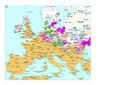 Europe en 200.pdf 1,752 × 1,239; 434 KB
-
 East-Hem 300ad (cropped).jpg 968 × 602; 107 KB
-
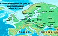
 GothicInvasions 267-269-sr.svg 1,030 × 1,076; 236 KB
-
 Ostmitteleuropa BV042518440.jpg 1,954 × 1,337; 292 KB
_in_der_Zeit_vom_1._bis_zum_3._Jahrhundert._Sanok_2013._bis_zum_III_Jahrhundert.jpg)
.jpg)

