Category:Maps of 8th-century Africa
English: Modern maps showing the history of Africa. Not to be confused with genuinely old 8th-century maps of Africa
Subcategories
This category has the following 3 subcategories, out of 3 total.
M
- Maps of the Idrisid dynasty (16 F)
- Maps of the Kingdom of Aksum (42 F)
- Maps of the Rustamid dynasty (27 F)
Media in category "Maps of 8th-century Africa"
The following 9 files are in this category, out of 9 total.
-

-
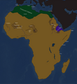
 Africa vèrs 750-800.png 603 × 682; 71 KB
-
 Africa-739 CE(Map).png 4,132 × 4,500; 1.62 MB
-
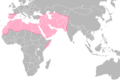
 Califate 750.jpg 1,492 × 1,248; 494 KB
-
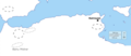
 Localisation des Meknassa VIIIe siècle.png 829 × 383; 59 KB
-
 Localisation Meknassa VIIIe siècle.png 851 × 368; 41 KB
-
 Meknassa 8th century v2.png 4,309 × 2,535; 993 KB
-
 Meknassa 8th century.png 4,824 × 1,953; 623 KB
-
 Umayyad-Empire.png 680 × 451; 24 KB
.jpg)

.png)


