Category:Maps of 8th-century India
Countries of Asia: India
Media in category "Maps of 8th-century India"
The following 14 files are in this category, out of 14 total.
-
 Arabsum5.png 1,000 × 1,066; 294 KB
-
 Arabsumf.png 1,000 × 1,056; 319 KB
-
 Arabsumf1.png 1,000 × 1,056; 335 KB
-
 Asian trade routes ca. AD 800.jpg 1,920 × 1,080; 772 KB
-
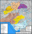
 India 755 CE (Prototype Test).png 2,358 × 1,724; 2.65 MB
-
 India 755 CE.png 1,630 × 1,720; 2.21 MB
-
 India 796 CE.png 1,630 × 1,720; 2.29 MB
-
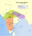
 Indian Kanauj triangle map-es.svg 1,539 × 1,735; 1.8 MB
-
 Indian Kanauj triangle map.svg 1,639 × 1,852; 389 KB
-
 Kamarupa 7th-8th Century AD.jpg 960 × 720; 485 KB
-
 Kannauj-triangelet år 750-900.svg 1,639 × 1,852; 387 KB
-
 Route taken by Pallavas to bring Nandivarman II.png 1,920 × 1,080; 2.03 MB
-
 Sindh 700ad-ar.png 720 × 473; 685 KB
-
 Sindh 700ad.jpg 720 × 473; 432 KB


.png)


