Category:Maps of 9th-century Bulgaria
Countries of Europe: Bulgaria · France‡ · Germany · Greece · Italy · Portugal‡ · Spain‡
‡: partly located in Europe
‡: partly located in Europe
| Preceded by: Maps of 8th-century Bulgaria |
Maps of 9th-century Bulgaria 801 AD-900 AD |
Succeeded by: Maps of 10th-century Bulgaria |
Subcategories
This category has only the following subcategory.
Media in category "Maps of 9th-century Bulgaria"
The following 18 files are in this category, out of 18 total.
-
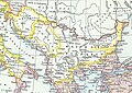
 Balkan 9 vek.png 560 × 423; 212 KB
-
 Balkans 900.png 1,140 × 793; 237 KB
-
 Balkans in 9th century.jpg 1,195 × 847; 339 KB
-
 Balkans in the 9th century.png 1,696 × 911; 1.54 MB
-
 Balkans850-es.svg 1,521 × 1,424; 1.49 MB
-
 Balkans850-it.svg 1,521 × 1,424; 1.67 MB
-
 Balkans850.png 628 × 517; 287 KB
-
 Bulgarernas land 893-927.PNG 627 × 599; 165 KB
-
 Bulgaria krum map pl.jpg 700 × 508; 114 KB
-
 Bulgaria under rule of Boris Ist.jpg 1,023 × 1,479; 305 KB
-
 Bulgarian Empire 814.svg 500 × 380; 771 KB
-
 Europe in 814, Charlemagne, Krum, Nicephorus I-ar.png 1,218 × 888; 165 KB
-
 Europe in 814, Charlemagne, Krum, Nicephorus I.png 1,218 × 888; 102 KB
-
 Europe in 814AD.png 1,218 × 888; 115 KB
-
 First Bulgarian Empire Xc.png 526 × 388; 56 KB
-
 Map Bulgaria Simeon-fr.svg 503 × 681; 85 KB
-
 Map Bulgaria Simeon-hu.svg 503 × 681; 78 KB
-
 Southeastern Europe Late Ninth Century.png 628 × 517; 288 KB


