Category:Maps of 9th-century India
Countries of Asia: India
Media in category "Maps of 9th-century India"
The following 6 files are in this category, out of 6 total.
-
 Hindu Shahi Dynasty.png 317 × 267; 246 KB
-
 India - Empèri Pratihara vèrs 900.png 426 × 520; 62 KB
-
 Indian Kanauj triangle map-es.svg 1,539 × 1,735; 1.8 MB
-
 Indian Kanauj triangle map.svg 1,639 × 1,852; 389 KB
-
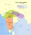 Kannauj-triangelet år 750-900.svg 1,639 × 1,852; 387 KB
-
 Map of Rashtrakuta Empire during Amoghavarsha Nrupatunga.jpg 1,080 × 1,226; 453 KB


