Category:Maps of Aboriginal Australia
This category shall contain maps relating to the aboriginals of Australia and the surrounding isles.
Subcategories
This category has the following 3 subcategories, out of 3 total.
Media in category "Maps of Aboriginal Australia"
The following 75 files are in this category, out of 75 total.
-

-

-
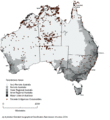
 Aboriginal Australians Distribution.jpg 376 × 408; 32 KB
-
 Aboriginal regions.png 1,425 × 1,278; 1.14 MB
-
 Aboriginal Tasmania Map.png 442 × 437; 26 KB
-
 Aboriginal Tribes near Adelaide.png 480 × 730; 40 KB
-
 Aboriginal Tribes of Riverena.png 318 × 305; 15 KB
-
 Aborigines Regionen.png 1,425 × 1,278; 854 KB
-
 Aborigines-Regionen.png 1,425 × 1,278; 858 KB
-
 Aborigènes d'Australie.png 500 × 472; 39 KB
-
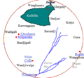
 Arnhemland tribes3.png 375 × 335; 17 KB
-
 Australian languages.png 350 × 350; 118 KB
-
 Badjari Map.png 510 × 478; 15 KB
-
 Barranbinya Lands.png 300 × 191; 5 KB
-
 Bassian plain 14000 BP.jpg 500 × 517; 60 KB
-
 Bassian plain 14000 BP.svg 469 × 485; 163 KB
-
 Carpentaria Gulf tribes1.png 571 × 355; 22 KB
-
 Carpentaria Gulf tribes2.png 423 × 334; 20 KB
-
 Câmpia Bassiană 14.000 BP.png 469 × 485; 65 KB
-
 Dharag-Neighbors1.png 549 × 330; 17 KB
-
-

-
 Djagaraga-Gudang territory in Cape York, Queensland, Australia.png 2,572 × 2,168; 103 KB
-
 Djirbalgan map.png 500 × 360; 124 KB
-
 Gunnawingu Tribe.png 725 × 576; 47 KB
-
 Guugu Yimithirr country.png 246 × 222; 19 KB
-
 Indigene Territorien Australiens 2022.jpg 2,776 × 2,481; 2.75 MB
-
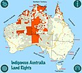 Indigenous Land Rights in Australia 2022.jpg 2,776 × 2,481; 3.24 MB
-
 Indigenous Native Titles in Australia 2022.jpg 2,776 × 2,481; 2.99 MB
-
 Karte Kulturareal Desert.png 1,218 × 977; 682 KB
-
 Kulltilla Map.png 511 × 479; 24 KB
-
 LAAL map site Jan2015.JPG 504 × 833; 57 KB
-
 Leibhéal Bassian 14000 BP.jpg 500 × 517; 128 KB
-
 Lenguas australianas.png 375 × 325; 67 KB
-
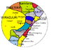
 Map of Karrenggapa Traditional Lands.png 514 × 492; 32 KB
-
 Map of New South Wales as occupied by the native tribes.jpg 2,000 × 1,750; 834 KB
-
 Map of South Australian native title claims and determinations, September 2023.pdf 3,506 × 4,964; 1.47 MB
-
 Map of the traditional lands of the Gulidjan people.png 336 × 325; 2 KB
-
 Map of the traditional lands of the Gundangurra people.png 314 × 310; 5 KB
-

-
 Map of Wanjiwalku Lands.png 326 × 307; 6 KB
-
 Map Victoria Aboriginal tribes (colourmap).jpg 3,523 × 2,447; 440 KB
-
 Murtu aboriginal people lands.png 551 × 488; 11 KB
-
 MuruwariLands.png 307 × 315; 1 KB
-
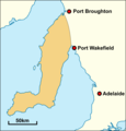 Narunggaland.png 541 × 564; 50 KB
-
 Native Title Determinations 2022 map.jpg 3,308 × 2,339; 618 KB
-
 Ngunawal Lands.png 243 × 191; 3 KB
-
 Nla.obj-234332820.tif 9,104 × 6,814; 177.5 MB
-
 Noongar regions map.svg 1,026 × 872; 181 KB
-
 Noongar1 es.jpg 960 × 720; 279 KB
-
 Noongar1 gl.jpg 960 × 720; 272 KB
-
 Noongar1 hi.jpg 960 × 720; 283 KB
-
 Noongar1 jv.jpg 960 × 720; 273 KB
-
 Noongar1 ml.jpg 960 × 720; 276 KB
-
 Noongar1 nl.jpg 960 × 720; 166 KB
-
 Noongar1 pt.jpg 960 × 720; 273 KB
-
 Noongar1.jpg 960 × 720; 278 KB
-
 Nukunu.JPG 292 × 247; 11 KB
-
 Pintupi country.png 1,226 × 800; 247 KB
-
 Roper River tribes, Northern Territory.png 247 × 215; 11 KB
-

-
 Tasmanian tribes fr.png 800 × 1,000; 1.09 MB
-
 Tasmanian tribes.JPG 799 × 965; 117 KB
-
 Tharrgari aboriginal people lands.png 551 × 488; 9 KB
-
 Traditional lands of Aboriginal tribes in Central NSW.png 312 × 320; 19 KB
-
 Traditional lands of Australian Aboriginal Tribes around Derby.png 549 × 330; 19 KB
-

-

-
 Traditional lands of the Gadubanud people.png 321 × 313; 5 KB
-

-
 Tribes around Gladstone1.png 972 × 949; 40 KB
-
 Warlpiri map.png 500 × 269; 120 KB
-
 Watson map tribes of south east Queensland.jpg 3,598 × 5,471; 940 KB
-
-
_(cropped).jpg)
.jpg)


.gif)
.gif)


.jpg)


.gif)
.gif)