Category:Maps of Allied occupation of Austria
Media in category "Maps of Allied occupation of Austria"
The following 20 files are in this category, out of 20 total.
-
 Austria LOC 2017585410.tif 12,236 × 8,019; 280.73 MB
-
 Austria, zones of occupation LOC 2017585413.tif 4,418 × 3,329; 42.08 MB
-
 Allied occupation in Austria (1945-1955).png 2,302 × 884; 142 KB
-
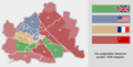
 Allied occupation sectors in Vienna (1945-1955).png 1,400 × 712; 78 KB
-
 Austria 1945-55 he.png 800 × 310; 50 KB
-
 Austria 1945-55.png 1,400 × 542; 60 KB
-
 Austria 1945-55.svg 1,400 × 542; 138 KB
-
 Austria LOC 2017585410.jpg 12,236 × 8,019; 8.74 MB
-
 Austria Occupation Zones 1945-55 en.svg 1,355 × 750; 164 KB
-
 Austria Occupation Zones 1945-55 hu.svg 1,355 × 750; 168 KB
-
 Austria Occupation Zones 1945-55-es.svg 1,355 × 750; 164 KB
-
 Austria Occupation Zones 1945-55.svg 1,355 × 750; 167 KB
-
 Austria, zones of occupation LOC 2017585413.jpg 4,418 × 3,329; 1.64 MB
-
 Karte Alliierte Besatzungszonen in Österreich von 1945 bis 1955.png 2,624 × 1,408; 335 KB
-
 Okupacja Austrii.png 605 × 286; 50 KB
-
 Vienna Allied sectors (1945-1955) hu.png 1,642 × 835; 294 KB
-
 Vienna Allied sectors (1945-1955).png 1,280 × 651; 172 KB
-
 Wien Besatzungszonen-he.png 1,280 × 651; 218 KB
-
 Wien Besatzungszonen.png 1,400 × 712; 92 KB
-
 Окупація Австрії союзниками 1945-55.svg 1,355 × 750; 154 KB
.png)


_hu.png)
.png)


.png)