Category:Maps of Almeida
Subcategories
This category has only the following subcategory.
M
Media in category "Maps of Almeida"
The following 8 files are in this category, out of 8 total.
-

-
 D-356-v 00001 t24-C-R0150 (mapa de alfaiates).jpg 2,566 × 2,038; 1,023 KB
-
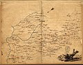
 Detalle mapa Portugal 1786 Bowen.jpg 891 × 582; 232 KB
-
 Kreis Almeida 2020.png 2,500 × 2,115; 955 KB
-
 LocalAlmeida.svg 250 × 366; 614 KB
-
 Map1-5maio.jpg 1,825 × 1,296; 432 KB
-
 Plano de Almeida.jpg 5,806 × 3,871; 13.19 MB
-
 Royaumes d'Espagne et de Portugal 1780 Rigobert Bonne (detalle noroeste).jpg 1,318 × 1,066; 788 KB
.jpg)
.jpg)


.jpg)