Category:Maps of Appalachia
English: Maps of the sociocultural region of Appalachia. For maps of the mountain range, see Category:Maps of the Appalachian Mountains
Subcategories
This category has only the following subcategory.
A
Media in category "Maps of Appalachia"
The following 16 files are in this category, out of 16 total.
-
 ADHSMap.png 1,547 × 1,703; 139 KB
-
 Animated map of ARC economic status.gif 456 × 487; 1.45 MB
-
 Appalachian Ohio within Appalachia.png 570 × 585; 55 KB
-
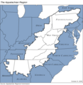 Appalachian region of United States.png 570 × 585; 56 KB
-
 ARC case A.jpg 621 × 485; 95 KB
-
 ARC case B.jpg 613 × 479; 90 KB
-
 ARC case C.jpg 615 × 474; 94 KB
-
 ARC case D.jpg 620 × 489; 86 KB
-
 ARC case E.jpg 635 × 482; 94 KB
-
 ARC counties as of 2023.svg 747 × 704; 1.61 MB
-
 ARC county stress FY 2024.svg 705 × 686; 2.15 MB
-
 ARC subregions as of July 2023.svg 705 × 686; 2.27 MB
-
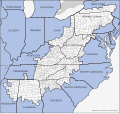
 Counties included in Appalachia map.svg 388 × 417; 1.72 MB
-
 Former ARC subregions.jpg 581 × 456; 86 KB
-
 Map of Appalachia without county borders.svg 512 × 841; 2.59 MB
-
 Subregions in Appalachia.png 506 × 494; 103 KB


