Category:Maps of Arteixo
Municipalities in the province of A Coruña: Abegondo · Ames · Aranga · Arteixo · Arzúa · A Baña · Bergondo · Betanzos · Boimorto · Boiro · Boqueixón · Brión · Cabana de Bergantiños · Cabanas · Camariñas · Cambre · A Capela · Carballo · Cariño · Carnota · Carral · Cedeira · Cee · Cerceda · Cerdido · Coirós · Corcubión · Coristanco · A Coruña · Culleredo · Curtis · Dodro · Dumbría · Fene · Ferrol · Fisterra · Frades · Irixoa · A Laracha · Laxe · Lousame · Malpica de Bergantiños · Mañón · Mazaricos · Melide · Mesía · Miño · Moeche · Monfero · Mugardos · Muros · Muxía · Narón · Neda · Negreira · Noia · Oleiros · Ordes · Oroso · Ortigueira · Outes · Oza-Cesuras · Paderne · Padrón · O Pino · A Pobra do Caramiñal · Ponteceso · Pontedeume · As Pontes de García Rodríguez · Porto do Son · Rianxo · Ribeira · Rois · Sada · San Sadurniño · Santa Comba · Santiago de Compostela · Santiso · Sobrado · As Somozas · Teo · Toques · Tordoia · Touro · Trazo · Val do Dubra · Valdoviño · Vedra · Vilarmaior · Vilasantar · Vimianzo · Zas
Subcategories
This category has only the following subcategory.
P
- Maps of parishes of Arteixo (14 F)
Media in category "Maps of Arteixo"
The following 5 files are in this category, out of 5 total.
-
 Karte Gemeinde Arteixo 2022.png 3,000 × 3,000; 1.13 MB
-
 MTN25-0045c1-1983-Arteijo.jpg 7,775 × 5,413; 7.67 MB
-
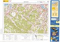
 MTN25-0045c1-2000-Arteixo.jpg 7,775 × 5,413; 10.84 MB
-
 MTN25-0045c1-2014-Arteixo.jpg 7,320 × 5,203; 19.03 MB
-
 Situacion Arteixo.PNG 956 × 1,008; 84 KB


