Category:Maps of Austria-Hungary by year
Subcategories
This category has the following 29 subcategories, out of 29 total.
- 1797 maps of Austria-Hungary (1 F)
- 1824 maps of Austria-Hungary (1 F)
- 1867 maps of Austria-Hungary (1 F)
- 1871 maps of Austria-Hungary (2 F)
- 1876 maps of Austria-Hungary (5 F)
- 1878 maps of Austria-Hungary (4 F)
- 1882 maps of Austria-Hungary (7 F)
- 1884 maps of Austria-Hungary (17 F)
- 1886 maps of Austria-Hungary (6 F)
- 1893 maps of Austria-Hungary (empty)
- 1896 maps of Austria-Hungary (3 F)
- 1897 maps of Austria-Hungary (4 F)
- 1898 maps of Austria-Hungary (8 F)
- 1900 maps of Austria-Hungary (3 F)
- 1901 maps of Austria-Hungary (1 F)
- 1910 maps of Austria-Hungary (10 F)
- 1913 maps of Austria-Hungary (23 F)
- 1917 maps of Austria-Hungary (1 F)
Media in category "Maps of Austria-Hungary by year"
The following 3 files are in this category, out of 3 total.
-
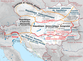 Austrian-Hungarian dissolution (fr).png 1,187 × 881; 1.04 MB
-
 Karl v. Habsburg 5 Kingdoms-Oct.16 1918 (v2).png 776 × 600; 105 KB
-
 Karl v. Habsburg 5 Kingdoms-Oct.16 1918.png 1,280 × 989; 269 KB
.png)
.png)
