Category:Maps of Bloye (Haute-Savoie)
Subcategories
This category has only the following subcategory.
Media in category "Maps of Bloye (Haute-Savoie)"
The following 12 files are in this category, out of 12 total.
-
 74035-Bloye - Localisation.png 3,507 × 2,480; 1.27 MB
-
 74035-Bloye-Cadastre.png 7,015 × 4,960; 5.16 MB
-
 74035-Bloye-Hydro.png 7,015 × 4,960; 3.08 MB
-
 74035-Bloye-Natura 2000.png 7,015 × 4,960; 2.61 MB
-
 74035-Bloye-Orthophoto.png 7,015 × 4,960; 4.46 MB
-
 74035-Bloye-Sols.png 7,015 × 4,960; 3.51 MB
-
 74035-Bloye-ZNIEFF1.png 7,015 × 4,960; 2.65 MB
-
 74035-Bloye-ZNIEFF2.png 7,015 × 4,960; 2.57 MB
-
 Bloye OSM 01.png 446 × 453; 92 KB
-
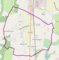
 Bloye OSM 02.png 446 × 453; 161 KB
-
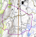
 Bloye OSM 03.png 427 × 436; 106 KB
-
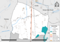
 Map commune FR insee code 74035.png 756 × 605; 39 KB


