Category:Maps of Borough of Gedling
Media in category "Maps of Borough of Gedling"
The following 9 files are in this category, out of 9 total.
-
 Arnold and Carlton unparished area UK locator map.svg 1,118 × 1,306; 207 KB
-
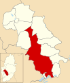
 Gedling UK local election 2003 map.svg 1,118 × 1,306; 245 KB
-
 Gedling UK local election 2007 map.svg 1,118 × 1,306; 244 KB
-
 Gedling UK local election 2011 map.svg 1,118 × 1,306; 245 KB
-
 Gedling UK locator map.svg 1,030 × 1,305; 906 KB
-
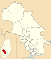
 Gedling UK ward map 2010 (blank).svg 1,118 × 1,306; 244 KB
-
 Gedling UK ward map 2015 (blank).svg 1,118 × 1,306; 317 KB
-
 GedlingINNottinghamshire.svg 354 × 623; 29 KB
-
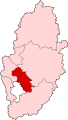
 NottinghamshireGedling.png 200 × 347; 20 KB


.svg)
.svg)