Category:Maps of Brijuni Islands
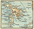
Media in category "Maps of Brijuni Islands"
The following 5 files are in this category, out of 5 total.
-
Admiralty Chart No 202 Port Pola and the Brioni Islands, Published 1872, New Edition 1914.jpg 11,044 × 8,376; 30.63 MB
-
Brijuni (hr).svg 702 × 575; 63 KB
-
Brioni Grande 1912.jpg 650 × 548; 118 KB
-
Croatia - Brioni.PNG 815 × 553; 46 KB
-
Pula BV044704957.jpg 1,992 × 968; 655 KB


