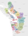
Category:Maps of British Columbia Indigenous territories
Media in category "Maps of British Columbia Indigenous territories"
The following 71 files are in this category, out of 71 total.
-
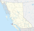
 CAN BC 'Namgis Nation locator.svg 1,944 × 1,737; 1.44 MB
-
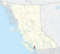
 CAN BC Acho Dene Koe First Nation locator.svg 1,944 × 1,737; 1.4 MB
-
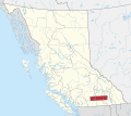
 CAN BC Allied Tribes of Lax Kw'alaams locator.svg 1,944 × 1,737; 1.47 MB
-
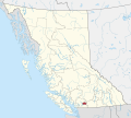
 CAN BC Carcross Tagish First Nation locator.svg 1,944 × 1,737; 1.39 MB
-
 CAN BC Carrier Sekani Tribal Council locator.svg 1,944 × 1,737; 1.43 MB
-
 CAN BC Champagne and Aishihik First Nations locator.svg 1,944 × 1,737; 1.39 MB
-
 CAN BC Cheslatta Carrier Nation locator.svg 1,944 × 1,737; 1.41 MB
-
 CAN BC Council of the Haida Nation locator.svg 1,944 × 1,737; 1.39 MB
-
 CAN BC Da'naxda'xw Awaetlatla Nation locator.svg 1,944 × 1,737; 1.41 MB
-
 CAN BC Ditidaht First Nation locator.svg 1,944 × 1,737; 1.41 MB
-
 CAN BC Esk'etemc First Nation locator.svg 1,944 × 1,737; 1.42 MB
-
 CAN BC Gitanyow Hereditary Chiefs locator.svg 1,944 × 1,737; 1.5 MB
-
 CAN BC Gitxsan Hereditary Chiefs locator.svg 1,944 × 1,737; 1.57 MB
-
 CAN BC Gwa'Sala-'Nakwaxda'xw Nation locator.svg 1,944 × 1,737; 1.42 MB
-
 CAN BC Haisla Nation locator.svg 1,944 × 1,737; 1.41 MB
-
 CAN BC Heiltsuk Nation locator.svg 1,944 × 1,737; 1.39 MB
-
 CAN BC Homalco Indian Band locator.svg 1,944 × 1,737; 1.42 MB
-
 CAN BC Hul'qumi'num Treaty Group (Core) locator.svg 1,944 × 1,737; 1.47 MB
-
 CAN BC Hul'qumi'num Treaty Group (Marine) locator.svg 1,944 × 1,737; 2.13 MB
-
 CAN BC Hupacasath First Nation locator.svg 1,944 × 1,737; 1.41 MB
-
 CAN BC In-SHUCK-ch Nation locator.svg 1,944 × 1,737; 1.5 MB
-
 CAN BC K'omoks First Nation locator.svg 1,944 × 1,737; 1.46 MB
-
 CAN BC Kaska Dena Council locator.svg 1,944 × 1,737; 1.43 MB
-
 CAN BC Katzie Indian Band locator.svg 1,944 × 1,737; 1.42 MB
-
 CAN BC Klahoose Indian Band locator.svg 1,944 × 1,737; 1.4 MB
-
 CAN BC Ktunaxa Kinbasket Treaty Council locator.svg 1,944 × 1,737; 1.67 MB
-
 CAN BC Kwakiutl Nation locator.svg 1,944 × 1,737; 1.39 MB
-
 CAN BC Laich-Kwil-Tach Council of Chiefs locator.svg 1,944 × 1,737; 1.44 MB
-
 CAN BC Lake Babine Nation locator.svg 1,944 × 1,737; 1.4 MB
-
 CAN BC Lheidli T'enneh First Nation locator.svg 1,944 × 1,737; 1.4 MB
-
 CAN BC McLeod Lake Indian Band locator.svg 1,944 × 1,737; 1.41 MB
-
 CAN BC Musqueam Nation locator.svg 1,944 × 1,737; 1.4 MB
-
 CAN BC Nazko First Nation locator.svg 1,944 × 1,737; 1.47 MB
-
 CAN BC Northern Shuswap Tribal Council locator.svg 1,944 × 1,737; 1.48 MB
-
 CAN BC Nuu-chah-nulth Tribal Council locator.svg 1,944 × 1,737; 1.54 MB
-
 CAN BC Pacheedaht Band locator.svg 1,944 × 1,737; 1.4 MB
-
 CAN BC Quatsino First Nation locator.svg 1,944 × 1,737; 1.4 MB
-
 CAN BC Sechelt Indian Band locator.svg 1,944 × 1,737; 1.43 MB
-
 CAN BC Snuneymuxw First Nation locator.svg 1,944 × 1,737; 1.44 MB
-
 CAN BC Squamish Nation locator.svg 1,944 × 1,737; 1.47 MB
-
 CAN BC Stolo Xwexwilmexw Treaty Association locator.svg 1,944 × 1,737; 1.45 MB
-
 CAN BC Taku River Tlingit First Nation locator.svg 1,944 × 1,737; 1.41 MB
-
 CAN BC Te'mexw Treaty Association locator.svg 1,944 × 1,737; 1.4 MB
-
 CAN BC Teslin Tlingit Council locator.svg 1,944 × 1,737; 1.39 MB
-
 CAN BC Tla-o-qui-aht First Nation locator.svg 1,944 × 1,737; 1.42 MB
-
 CAN BC Tlatlasikwala Nation locator.svg 1,944 × 1,737; 1.4 MB
-
 CAN BC Tlowitsis First Nation locator.svg 1,944 × 1,737; 1.4 MB
-
 CAN BC Tsay Keh Dene Band locator.svg 1,944 × 1,737; 1.42 MB
-
 CAN BC Tsimshian First Nations locator.svg 1,944 × 1,737; 1.43 MB
-
 CAN BC Tsleil-Waututh Nation locator.svg 1,944 × 1,737; 1.41 MB
-
 CAN BC Wei Wai Kum Kwiakah First Nations locator.svg 1,944 × 1,737; 1.72 MB
-
 CAN BC Westbank First Nation locator.svg 1,944 × 1,737; 1.39 MB
-
 CAN BC Wet'suwet'en Nation locator.svg 1,944 × 1,737; 1.44 MB
-
 CAN BC Wuikinuxv Nation locator.svg 1,944 × 1,737; 1.4 MB
-
 CAN BC Yale First Nation locator.svg 1,944 × 1,737; 1.56 MB
-
 CAN BC Yekooche First Nation locator.svg 1,944 × 1,737; 1.42 MB
-
 Coast Salish language map.svg 512 × 648; 84 KB
-
 Hagwilget First Nation location.svg 512 × 395; 2.52 MB
-
 HaidaGwaii2022OSM.png 4,071 × 5,916; 11.17 MB
-
 Nee-Tahi-Buhn First Nation location.svg 512 × 395; 2.52 MB
-
 NmTC member territories 2012.jpg 1,079 × 1,439; 329 KB
-
 Skin Tyee First Nation location.svg 512 × 395; 2.52 MB
-
 Songhees.png 1,757 × 1,196; 4.13 MB
-
 Squamish-Territory-Wiki-Map.svg 612 × 792; 1.38 MB
-
 Tsilhqot'in bands.svg 512 × 432; 48 KB
-
 Tsimshianic map.svg 512 × 640; 258 KB
-
 Tsʼil Kaz Koh location.svg 512 × 395; 2.52 MB
-
 Wetsuweten.svg 512 × 395; 2.52 MB
-
 Wetsuwetenwithpipe.svg 512 × 395; 2.52 MB
-
 Wetʼsuwetʼen First Nation location.svg 512 × 395; 2.52 MB
-
 Witset First Nation location.svg 512 × 395; 2.52 MB


_locator.svg)
_locator.svg)


