Category:Maps of British West Florida
Media in category "Maps of British West Florida"
The following 11 files are in this category, out of 11 total.
-
 Map of British West Florida showing 1763 and 1764 boundaries.jpg 600 × 398; 45 KB
-
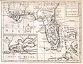 1763 Gibson Map of East and West Florida - Geographicus - Florida-GM-1763.jpg 3,081 × 2,374; 1.18 MB
-
 A draught of West Florida, from Cape St. Blaze to the River Iberville.jpg 11,934 × 4,971; 27 MB
-

-
 BritishWestFlorida1776.jpg 1,752 × 908; 597 KB
-
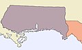 Map Of West Florida.jpg 800 × 485; 27 KB
-
 Map to Illustrate the Acquisition of West Florida-es.svg 1,702 × 760; 711 KB
-
 Map to Illustrate the Acquisition of West Florida.jpg 1,232 × 879; 368 KB
-
 NorthAmerica1762-83.png 787 × 600; 90 KB
-
 West Florida Map 1767.jpg 448 × 280; 33 KB
-
 Westfloridaitsre00cham 0010.jpg 2,616 × 1,920; 456 KB


