Category:Maps of Caernarfon
Media in category "Maps of Caernarfon"
The following 9 files are in this category, out of 9 total.
-
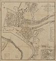 Caernarvon town plan 4669576.jpg 2,151 × 2,315; 2.85 MB
-
 Caernarfon v bangor.JPG 928 × 719; 116 KB
-
 Caernarfon.1610 cropped.jpg 1,790 × 1,149; 414 KB
-
 Caernarfon.1610.jpg 1,800 × 1,303; 318 KB
-
 Caernarvon bar and harbour.gif 1,000 × 745; 195 KB
-
 Ordnance Survey One-Inch Sheet 41 Anglesey, Published 1922.jpg 13,542 × 11,131; 45.63 MB
-
 Roy 1777 Plate 18 Triangulation of Snowdon and Moel Eilio philosophicaltra6717roya 0847.jpg 4,130 × 3,170; 1.82 MB
-
 Roy 1777 Triangulation of Snowdon and Moel Eilio 00907249 0159-0164.jpg 9,410 × 7,383; 26.6 MB
-
 Speed Carnarvon insert.jpg 758 × 583; 285 KB


