Category:Maps of Chaldea
Media in category "Maps of Chaldea"
The following 23 files are in this category, out of 23 total.
-
 MACCOUN(1899) p031 ABOUT 2300 B.C. - MESOPOTAMIA AND CHALDEA.jpg 3,626 × 1,936; 1.96 MB
-

-

-
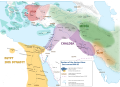
 Alter Orient 0600BC.svg 2,102 × 1,510; 4.95 MB
-
 Alter Orient 0700BC.svg 2,102 × 1,510; 4.7 MB
-
 Alter Orient 0800BC-es.svg 2,102 × 1,510; 3.54 MB
-
 Alter Orient 0800BC.svg 2,102 × 1,510; 4.81 MB
-
 AlterOrient.jpg 1,400 × 940; 454 KB
-
 Ancient Near East 0700BC.svg 2,102 × 1,510; 4.7 MB
-
 Ancient Near East 0800BC.svg 2,102 × 1,510; 4.81 MB
-
 Babylonie chaldeens.svg 618 × 467; 471 KB
-
 Chaldea - Map - Chaldea and Neighboring Countries.png 640 × 839; 78 KB
-
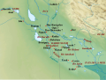
 Chaldea - Map - The Countries around Chaldea.png 632 × 458; 75 KB
-
 D517- Sources de pétrole en Chaldée. -L2-Ch 3.jpg 1,067 × 1,407; 197 KB
-
 D517- Sources de pétrole en Chaldée. -L2-Ch 3.png 1,524 × 2,010; 249 KB
-
 D547- Anciennes villes de la Chaldée. -L2-Ch 3.jpg 1,074 × 1,210; 184 KB
-
 D547- Anciennes villes de la Chaldée. -L2-Ch 3.png 1,534 × 1,728; 189 KB
-
 History of Egypt, Chaldea, Syria, Babylonia and Assyria (1903) (14740579446).jpg 2,352 × 1,554; 1.19 MB
-
 Iraq area, 586 B.C..png 741 × 688; 1.09 MB
-

-
 Map of ancient Assyria, Description de L'Universe (Alain Manesson Mallet, 1719).jpg 1,040 × 1,243; 279 KB
-

-
 Near East 600BC.svg 2,102 × 1,510; 4.93 MB
_p031_ABOUT_2300_B.C._-_MESOPOTAMIA_AND_CHALDEA.jpg)
%27_(11096604854).jpg)
_(14595630269).jpg)


_(14740579446).jpg)

.jpg)
.jpg)
_Empires,_H._G._Wells%27_Outline_of_History,_page_151.jpg)
