Category:Maps of Chicopee, Massachusetts
Subcategories
This category has the following 2 subcategories, out of 2 total.
Media in category "Maps of Chicopee, Massachusetts"
The following 20 files are in this category, out of 20 total.
-

-

-

-

-

-
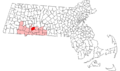 Chicopee ma highlight.png 788 × 466; 54 KB
-
 Chicopee, Mass. 1878. LOC 74693246.jpg 7,904 × 6,160; 10.05 MB
-
 Chicopee, Mass. 1878. LOC 74693246.tif 7,904 × 6,160; 139.3 MB
-
 City of Chicopee (9475311496).jpg 800 × 564; 87 KB
-
 Combined map of Holyoke and Chicopee (3886418475).jpg 1,733 × 2,000; 3.06 MB
-

-

-

-

-

-

-
 Springfield, 1827 - surveyed by direction of the town, 1826 LOC 2011589318.jpg 4,826 × 5,941; 4.38 MB
-
 Springfield-Chicopee-Holyoke Central Business Districts (1977 Census of Trade).jpg 1,330 × 1,676; 1.15 MB
-

-

.jpg)
.jpg)
.jpg)
.jpg)
_-_Hampden_County_-_Chicopee_-_ED_7-17_to_85,_7-207_to_208_-_NARA_-_12549062.jpg)


.jpg)
.jpg)


.jpg)
.jpg)
