Category:Maps of Clinton County, Iowa
Counties of Iowa: Adair · Adams · Allamakee · Appanoose · Audubon · Benton · Black Hawk · Boone · Bremer · Buchanan · Buena Vista · Butler · Calhoun · Carroll · Cass · Cedar · Cerro Gordo · Cherokee · Chickasaw · Clarke · Clay · Clayton · Clinton · Crawford · Dallas · Davis · Decatur · Delaware · Des Moines · Dickinson · Dubuque · Emmet · Fayette · Floyd · Franklin · Fremont · Greene · Grundy · Guthrie · Hamilton · Hancock · Hardin · Harrison · Henry · Howard · Humboldt · Ida · Iowa · Jackson · Jasper · Jefferson · Johnson · Jones · Keokuk · Kossuth · Lee · Linn · Louisa · Lucas · Lyon · Madison · Mahaska · Marion · Marshall · Mills · Mitchell · Monona · Monroe · Montgomery · Muscatine · O'Brien · Osceola · Page · Palo Alto · Plymouth · Pocahontas · Polk · Pottawattamie · Poweshiek · Ringgold · Sac · Scott · Shelby · Sioux · Story · Tama · Taylor · Union · Van Buren · Wapello · Warren · Washington · Wayne · Webster · Winnebago · Winneshiek · Woodbury · Worth · Wright
Wikimedia category | |||||
| Upload media | |||||
| Instance of | |||||
|---|---|---|---|---|---|
| Category combines topics | |||||
| Clinton County | |||||
county in Iowa, United States   | |||||
| Instance of | |||||
| Named after | |||||
| Location | Iowa | ||||
| Capital | |||||
| Inception |
| ||||
| Population |
| ||||
| Area |
| ||||
| Different from | |||||
| official website | |||||
 | |||||
Media in category "Maps of Clinton County, Iowa"
The following 52 files are in this category, out of 52 total.
-

-

-

-

-

-
-
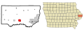
 Clinton County Iowa Incorporated and Unincorporated areas Delmar Highlighted.svg 1,050 × 400; 115 KB
-

-

-

-
-

-
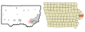
 Clinton County Iowa Incorporated and Unincorporated areas Welton Highlighted.svg 1,050 × 400; 115 KB
-

-
 Clinton County Iowa.png 300 × 194; 10 KB
-
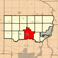
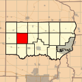
 ClintonCtIATownships.png 700 × 510; 241 KB
-
 IAMap-doton-Andover.PNG 300 × 194; 12 KB
-
 IAMap-doton-Calamus.PNG 300 × 194; 12 KB
-
 IAMap-doton-Camanche.PNG 300 × 194; 12 KB
-
 IAMap-doton-Charlotte.PNG 300 × 194; 12 KB
-
 IAMap-doton-Delmar.PNG 300 × 194; 12 KB
-
 IAMap-doton-DeWitt.PNG 300 × 194; 12 KB
-
 IAMap-doton-GooseLake.PNG 300 × 194; 12 KB
-
 IAMap-doton-GrandMound.PNG 300 × 194; 12 KB
-
 IAMap-doton-LostNation.PNG 300 × 194; 12 KB
-
 IAMap-doton-LowMoor.PNG 300 × 194; 12 KB
-
 IAMap-doton-Toronto.PNG 300 × 194; 12 KB
-
 IAMap-doton-Welton.PNG 300 × 194; 12 KB
-
 IAMap-doton-Wheatland.PNG 300 × 194; 12 KB
-
 Map highlighting Bloomfield Township, Clinton County, Iowa.svg 512 × 512; 74 KB
-
 Map highlighting Brookfield Township, Clinton County, Iowa.svg 512 × 512; 86 KB
-
 Map highlighting Camanche Township, Clinton County, Iowa.svg 512 × 512; 100 KB
-
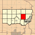 Map highlighting Center Township, Clinton County, Iowa.svg 512 × 512; 108 KB
-
 Map highlighting De Witt Township, Clinton County, Iowa.svg 512 × 512; 124 KB
-
 Map highlighting Deep Creek Township, Clinton County, Iowa.svg 512 × 512; 130 KB
-
 Map highlighting Eden Township, Clinton County, Iowa.svg 512 × 512; 147 KB
-
 Map highlighting Elk River Township, Clinton County, Iowa.svg 512 × 512; 155 KB
-
 Map highlighting Grant Township, Clinton County, Iowa.svg 512 × 512; 163 KB
-
 Map highlighting Hampshire Township, Clinton County, Iowa.svg 512 × 512; 177 KB
-
 Map highlighting Liberty Township, Clinton County, Iowa.svg 512 × 512; 184 KB
-
 Map highlighting Olive Township, Clinton County, Iowa.svg 512 × 512; 206 KB
-
 Map highlighting Orange Township, Clinton County, Iowa.svg 512 × 512; 215 KB
-
 Map highlighting Sharon Township, Clinton County, Iowa.svg 512 × 512; 217 KB
-
 Map highlighting Spring Rock Township, Clinton County, Iowa.svg 512 × 512; 231 KB
-
 Map highlighting Washington Township, Clinton County, Iowa.svg 512 × 512; 242 KB
-
 Map highlighting Waterford Township, Clinton County, Iowa.svg 512 × 512; 253 KB
-
 Map highlighting Welton Township, Clinton County, Iowa.svg 512 × 512; 264 KB
-
 Map of Clinton County, Iowa - NARA - 100306141 (page 1).jpg 8,132 × 13,063; 8.18 MB
-
 Map of Clinton County, Iowa - NARA - 100306141 (page 2).jpg 10,084 × 13,120; 11.74 MB
-
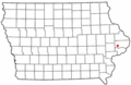
 Map of Iowa highlighting Clinton County.svg 5,350 × 3,504; 43 KB
-
 Map of the Town of Clinton, Iowa - NARA - 100306144 (page 1).jpg 7,400 × 12,997; 8.67 MB
-
 Map of the Town of Clinton, Iowa - NARA - 100306144 (page 2).jpg 7,484 × 12,884; 4.35 MB


.jpg)
.jpg)
.jpg)
.jpg)