Category:Maps of Dehong
Subcategories
This category has the following 6 subcategories, out of 6 total.
- Maps of Longchuan, Yunnan (3 F)
M
- Maps of Lianghe (3 F)
- Maps of Yingjiang (4 F)
Media in category "Maps of Dehong"
The following 11 files are in this category, out of 11 total.
-
 1330德宏.png 4,619 × 4,223; 958 KB
-
 2011 Yunnan earthquake Shakemap.jpg 612 × 710; 124 KB
-
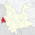
 Administrative Division Dehong.png 1,720 × 2,360; 258 KB
-
 Dehong in Yunnan.svg 1,318 × 1,325; 346 KB
-
 Dehong mcp.png 348 × 481; 16 KB
-
 Dehong mcp02.png 696 × 962; 77 KB
-
 Dehong.png 1,200 × 1,200; 387 KB
-
 International Border of Dehong.svg 744 × 1,052; 7 KB
-
 Location of Dehong Prefecture within Yunnan (China).png 880 × 650; 94 KB
-
 Yunnan subdivisions - Dehong.svg 944 × 999; 28 KB
-
 德宏傣族景颇族自治州位置图.jpg 5,905 × 5,977; 2.4 MB


.png)

