Category:Maps of Depsang Plains
plain in India | |||||
| Upload media | |||||
| Instance of | |||||
|---|---|---|---|---|---|
| Location |
| ||||
 | |||||
Media in category "Maps of Depsang Plains"
The following 13 files are in this category, out of 13 total.
-
 1960 Northern Frontier of India by SOI.jpg 4,384 × 3,252; 1.02 MB
-
 1963 Colombo proposals in Depsang Plains.jpg 793 × 745; 198 KB
-
 Depsang Bulge claim lines (1962).jpg 1,323 × 903; 357 KB
-
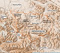 Depsang Bulge.jpg 1,106 × 975; 535 KB
-
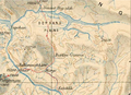 Depsang Plains Survey of India map 1916.png 936 × 682; 1.4 MB
-
 Depsang Siachen.jpg 1,200 × 624; 361 KB
-
 Depsang-Bulge-LSIB-2020.jpg 1,068 × 592; 52 KB
-
 Depsang-Bulge-mouth-2020.jpg 1,364 × 598; 97 KB
-
 Jammu and Kashmir in 1947 Political Map of India.jpg 1,385 × 1,015; 501 KB
-
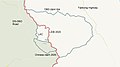
 Raki-Jeong-Nalas-LSIB-vs-Chinese-claims.png 897 × 656; 51 KB
-
 Raki-Nala-LSIB-vs-Chinese-claims.jpg 938 × 646; 63 KB
-
 Txu-pclmaps-oclc-181831961-52-i-kara-tagh-pass-1914.jpg 3,379 × 5,054; 1.66 MB
-
 Txu-pclmaps-oclc-181831961-52-i-kushku-maidan-1873.jpg 3,391 × 4,648; 2.8 MB


.jpg)


