Category:Maps of East Florida
Subcategories
This category has only the following subcategory.
M
Media in category "Maps of East Florida"
The following 10 files are in this category, out of 10 total.
-
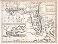 1763 Gibson Map of East and West Florida - Geographicus - Florida-GM-1763.jpg 3,081 × 2,374; 1.18 MB
-
 East and West Florida 1803 Cary Map.png 846 × 635; 1.37 MB
-
 East and West Florida 1810-es.svg 731 × 505; 872 KB
-
 East and West Florida 1810.jpg 412 × 245; 44 KB
-
 EB9 United States - historical maps (top).jpg 2,488 × 1,803; 997 KB
-
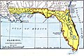 Map of East and West Florida in 1819.jpg 632 × 420; 148 KB
-
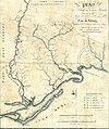 Map of the Forbes Purchase (9124181511).jpg 1,000 × 1,194; 1.41 MB
-
 Pinckney's Treaty line 1795.png 1,164 × 981; 707 KB
-

-
 Thomas Jefferys' map of the Bay of Espiritu Santo.jpg 779 × 600; 211 KB


.jpg)

.jpg)


