Category:Maps of European Upper Paleolithic
Media in category "Maps of European Upper Paleolithic"
The following 60 files are in this category, out of 60 total.
-
 8500bce.PNG 471 × 380; 13 KB
-
 Ancylus Lakey 7500-BC bulgarian.png 800 × 1,087; 366 KB
-
 Ancylussee.svg 961 × 1,306; 672 KB
-
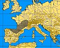
 Aurignacian culture map-de.svg 720 × 540; 417 KB
-
 Aurignacian culture map-es.png 767 × 575; 243 KB
-
 Aurignacian culture map-es.svg 720 × 540; 354 KB
-
 Aurignacian culture map-fr.svg 720 × 540; 90 KB
-
 Badegoulian culture map 3.png 1,003 × 739; 776 KB
-
 Badegoulian culture map.png 602 × 738; 804 KB
-
 Badegoulien culture map 2.png 800 × 957; 913 KB
-
 Baltic History 5000-BC-es.svg 961 × 1,306; 790 KB
-
 Baltic History 5000-BC.svg 961 × 1,306; 721 KB
-
 Baltic History 5500-BC.svg 961 × 1,306; 814 KB
-
 Baltic History 7500-BC Ru.svg 961 × 1,306; 653 KB
-
 Baltic History 7500-BC-ar.svg 961 × 1,306; 876 KB
-
 Baltic History 7500-BC-es.svg 961 × 1,306; 757 KB
-
 Baltic History 7500-BC.png 800 × 1,087; 342 KB
-
 Baltic History 7500-BC.svg 961 × 1,306; 652 KB
-
 Baltischer EisstauseeX.png 2,000 × 2,684; 1.23 MB
-
 Cartepaleosup froid.png 300 × 306; 12 KB
-
 Cro-Magnon migration.gif 503 × 443; 127 KB
-
 Cro-Magnon range 30,000 ybp.svg 147 × 130; 286 KB
-
 Cro-Magnon range 32,500 ybp.svg 147 × 130; 294 KB
-
 Cro-Magnon range 35,000 ybp.svg 147 × 130; 275 KB
-
 Cro-Magnon range 37,500 ybp.svg 147 × 130; 271 KB
-
 Doggerland-cy.svg 545 × 600; 122 KB
-
 Doggerland.svg 545 × 600; 165 KB
-
 Europe20000ya.png 1,900 × 1,264; 98 KB
-
 Franco-Cantabrian region.gif 956 × 482; 21 KB
-
 Hamburg culture map 2.png 978 × 671; 606 KB
-
 Hamburg culture map.png 1,316 × 805; 943 KB
-
 Homo Sapiens in Europe - magdalenian distribution map-de.svg 2,000 × 1,150; 121 KB
-
 Homo Sapiens in Europe - magdalenian distribution map-es.svg 2,000 × 1,150; 592 KB
-
 Homo Sapiens in Europe - magdalenian distribution map-fr.svg 2,000 × 1,150; 127 KB
-
 Homo Sapiens in Europe - solutrean distribution map-de.svg 1,150 × 760; 59 KB
-
 Homo Sapiens in Europe - solutrean distribution map-en.svg 1,227 × 811; 58 KB
-
 Homo Sapiens in Europe - solutrean distribution map-es.svg 1,150 × 760; 237 KB
-
 Homo Sapiens in Europe - solutrean distribution map-fr.svg 1,150 × 760; 59 KB
-
 Janisławicka.jpg 854 × 622; 484 KB
-
 Kompleks Jerzmanowician-Ranisian-Lincombian zasięg.jpg 788 × 490; 337 KB
-
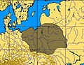
 Kultura ahrensburska.jpg 834 × 612; 471 KB
-
 Kultura azylska.jpg 682 × 551; 345 KB
-
 Kultura lyngbijska.jpg 852 × 512; 375 KB
-
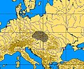
 Kultura oryniacka.jpg 1,197 × 783; 924 KB
-
 Kultura szelecka zasięg.jpg 672 × 552; 337 KB
-
 Kulture desneńska zasięg.jpg 780 × 534; 386 KB
-
 Lepenski vir culture-sr.png 822 × 650; 29 KB
-
 Lepenski vir culture.png 822 × 650; 34 KB
-
 Litorinameri 5000 eaa.svg 961 × 1,306; 697 KB
-
 Map of Palaeolithic Art.png 906 × 567; 333 KB
-
 Nordsjølandet.JPG 385 × 443; 73 KB
-
 Palaeolithic migrations.jpg 7,140 × 2,944; 3.48 MB
-
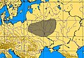
 Swiderian culture.jpg 544 × 423; 217 KB
-
 Swiderien.svg 959 × 940; 899 KB
-
 The American Museum journal (1912) (18156934902).jpg 3,780 × 1,696; 1 MB
-
 Upper Paleolihic Art in Europe.gif 570 × 388; 18 KB
-
 Yolda MeerX.png 1,994 × 2,716; 1.21 MB
-
 Анцилово море (7500 - 6000 г. преди новата ера).png 4,608 × 5,112; 671 KB
-
 Анциловото езеро.png 800 × 1,087; 366 KB
-
 Литорино море (5 000 г.пр.н.е.).png 800 × 1,087; 363 KB


_(18156934902).jpg)


.png)

.png)