Category:Maps of Finger Lakes region
Media in category "Maps of Finger Lakes region"
The following 12 files are in this category, out of 12 total.
-
 1g Upstate New York.jpg 526 × 290; 32 KB
-
 Annual report of the Regents - New York State Museum. (1908) (19366506655).jpg 2,191 × 3,252; 986 KB
-
 Bulletin of the Buffalo Society of Natural Sciences (1910) (19824589144).jpg 2,210 × 3,618; 3.49 MB
-
 Carpenter-Point-Tenmile-Point-Lake-Skaneateles-New York-map.png 1,144 × 786; 236 KB
-
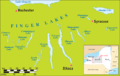 Fingerlakesmap.png 800 × 509; 191 KB
-
 Fingerlakesmap2.PNG 1,078 × 620; 29 KB
-
 FMIB 39121 Index map of the drainage of the Finger Lake district.jpeg 1,477 × 1,085; 384 KB
-
 Martville-New-York-1904-map.jpg 1,659 × 2,088; 1,009 KB
-
 New York - Finger Lakes region map with road shields.png 2,640 × 2,320; 896 KB
-
 New York - Finger Lakes region map with road shields.svg 1,583 × 1,156; 803 KB
-
 Oswegorivermap.png 1,000 × 1,000; 414 KB
-
 Oswegorivermaphighres.png 2,550 × 2,550; 768 KB

_(19366506655).jpg)
_(19824589144).jpg)


