Category:Maps of German New Guinea
Media in category "Maps of German New Guinea"
The following 47 files are in this category, out of 47 total.
-
-
 113 kaiser-wilhelms-land-bismarck-archipel-und-samoa-inseln (1905).png 1,761 × 1,094; 1.23 MB
-

-
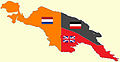
 1888년과 1899년 독일령 뉴기니.png 756 × 706; 62 KB
-

-
 Alexishafen, Astrolabe Bay, 1883.jpg 1,882 × 2,141; 887 KB
-
 Bita paka location 1914.jpg 350 × 384; 109 KB
-
 Die Deutschen Besitzungen im Stillen Ocean 11657068.jpg 13,359 × 10,744; 45.89 MB
-

-
 Die deutschen Besitzungen im Stillen Ozean.png 7,400 × 8,274; 84.73 MB
-

-
 Die Gartenlaube (1886) b 111.jpg 1,158 × 974; 185 KB
-
 Die Gartenlaube (1887) b 460 1.jpg 1,696 × 980; 321 KB
-
 Fly River 1876.tif 1,742 × 1,435; 7.18 MB
-
 Fly River Map 1876 NLA.jpg 1,950 × 1,300; 475 KB
-
 German New Guinea (1914; orthographic projection).png 1,024 × 1,024; 230 KB
-
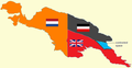
 German new guinea 1888 1899-ar.png 642 × 600; 77 KB
-
 German new guinea 1888 1899.png 756 × 706; 74 KB
-
 German New Guinea.png 1,000 × 1,000; 196 KB
-
 German Oceania, 1914.jpg 1,094 × 876; 224 KB
-
 Kaiser Wilhelms-Land Ost Neu Guinea 1884-1885 map.jpg 516 × 384; 273 KB
-
 Kaiser-Wilhelms-Land (crop from Brockhaus).jpg 2,852 × 2,016; 2.97 MB
-
 Kaiser-Wilhelms-Land-Brockhaus b10 nr0030a hfid 5181872.jpg 5,480 × 2,805; 5.75 MB
-
 Kiriwina Group (Trobriand Islands) 1891 map nla obj-231909085-1 (retouched).jpg 5,000 × 6,147; 10.4 MB
-
 Kiriwina Group (Trobriand Islands) 1891 map nla.obj-231909085-1.jpg 5,000 × 6,147; 11.13 MB
-
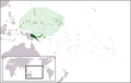 LocationGermanNewGuinea.png 250 × 158; 6 KB
-
 Map of British New-Guinea, shewing part of Kaiser Wilhelm land.png 11,967 × 8,381; 98.37 MB
-
 Map of Finschhafen - Papua New Guinea - 1884 - 1885.jpg 442 × 676; 70 KB
-
 Map of Germany's western Pacific colonies as of 1910 (map0005325727).jpg 3,000 × 2,073; 5.97 MB
-
 Map of Huon Gulf from Samoafahrten by Otto Finsch.jpg 458 × 575; 191 KB
-
 Map-Kaiser-Wilhelms-Land-und-Bismarck-Archipel-2.png 1,284 × 810; 701 KB
-
 Map-Kaiser-Wilhelms-Land-und-Bismarck-Archipel.png 2,314 × 1,456; 2.14 MB
-
 Neu-Mecklenburg.jpg 710 × 500; 334 KB
-
 New Guinea (1884-1919) w contested boundary.png 618 × 319; 25 KB
-
 New Guinea (1884-1919).png 618 × 319; 60 KB
-
 New Guinea 1884-1919 w contested boundary.png 618 × 319; 26 KB
-
 New Guinea and New Caledonia 1884 (Papua New Guinea).jpg 1,600 × 1,083; 347 KB
-
 NuevGuineaAlemana1888-1899.svg 505 × 395; 1.61 MB
-
 Ohos et Ouhas.jpg 1,742 × 1,435; 2.59 MB
-
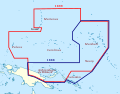
 Operation Typhoon.png 979 × 923; 660 KB
-
 Pacific-German-Colonies-es.svg 3,057 × 2,000; 249 KB
-
 Pacific-German-Colonies.svg 789 × 516; 66 KB
-
 Territorios coloniales de Nueva Guinea.PNG 789 × 330; 34 KB
-
 Wirtschafts-Atlas der deutschen Kolonien - 24.jpg 2,521 × 3,352; 754 KB
-
 Deutscher Kolonialatlas mit Jahrbuch 1910 (133566329).jpg 7,155 × 7,217; 53.96 MB
-
 Übersicht Der Deutschen Besitzungen im Stillen Ozean.jpg 1,019 × 1,029; 391 KB
-
 독일령 뉴기니.png 1,000 × 1,000; 201 KB
.jpg)
.png)
.jpg)

.jpg)


.jpg)


_b_111.jpg)
_b_460_1.jpg)

.png)


.jpg)

_1891_map_nla_obj-231909085-1_(retouched).jpg)
_1891_map_nla.obj-231909085-1.jpg)


.jpg)


_w_contested_boundary.png)
.png)

.jpg)


.jpg)

