Category:Maps of Gorkha District
Media in category "Maps of Gorkha District"
The following 23 files are in this category, out of 23 total.
-
 Aarughat.png 900 × 706; 84 KB
-
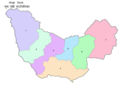
 Ajirkot.png 900 × 991; 77 KB
-
 Bhimsen.png 900 × 723; 81 KB
-
 Chumnubri.png 900 × 672; 87 KB
-
 Dharche.png 900 × 758; 97 KB
-
 Gandaki.png 900 × 768; 89 KB
-
 Gorkha District .png 540 × 692; 227 KB
-
 Gorkha District in Nepal 2015.svg 1,100 × 721; 812 KB
-
 Gorkha district location.png 800 × 550; 30 KB
-
 Gorkha Gandaki locator.png 1,070 × 1,024; 258 KB
-
 Gorkha1PradeshSabha.png 1,993 × 2,775; 126 KB
-
 Gorkha1PratinidhiSabha.png 1,993 × 2,775; 117 KB
-
 Gorkha1PratinidihiSabha.svg 750 × 700; 176 KB
-
 Gorkha2PradeshSabha.png 1,993 × 2,775; 125 KB
-
 Gorkha2PratinidhiSabha.png 1,993 × 2,775; 116 KB
-
 Gorkha2PratinidihiSabha.svg 750 × 700; 176 KB
-
 NepalGorkhaDistrictmap.png 2,479 × 3,508; 342 KB
-
 Palungtar Map.png 540 × 696; 88 KB
-
 Palungtar Municipality Map.jpg 323 × 313; 39 KB
-
 Palungtar Nagarpalika Map.jpg 994 × 769; 218 KB
-
 Sahid Lakhan.png 900 × 633; 76 KB
-
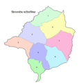 Siranchok.png 900 × 920; 92 KB
-
 Sulikot.png 900 × 980; 76 KB


