Category:Maps of Harpers Ferry, West Virginia
Subcategories
This category has only the following subcategory.
Media in category "Maps of Harpers Ferry, West Virginia"
The following 9 files are in this category, out of 9 total.
-
 Harper's Ferry (1863) LOC 99448910.jpg 8,609 × 7,150; 13.64 MB
-
 Harpers Ferry 1863.jpg 8,830 × 7,558; 17.06 MB
-
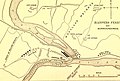 Harpers Ferry and surroundings.jpg 819 × 550; 170 KB
-
 Map of Harpers Ferry, Virginia in 1859.jpg 1,069 × 1,623; 965 KB
-
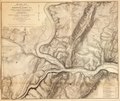
 Map of Harpers Ferry.jpg 841 × 858; 206 KB
-
 Military maps of the war of the Rebellion-miscellaneous, (1865-1879). LOC 2009581114-24.tif 9,110 × 7,710; 200.95 MB
-
 Sketch of the vicinity of Harpers Ferry, (W.) Va., by Wm. Luce, Oct. 1862 - NARA - 305575.tif 5,200 × 4,414; 65.67 MB
-
 Vicinity of Winchester and Harper's Ferry, Va. LOC gvhs01.vhs00271.jpg 2,736 × 2,232; 921 KB
-

_LOC_99448910.jpg)


.jpg)