Category:Maps of Hartford City, Indiana
- 100 most populous cities of the United States
- 1–25
- Austin
- Boston
- Charlotte
- Chicago
- Columbus
- Dallas
- Denver
- El Paso
- Fort Worth
- Houston
- Indianapolis
- Jacksonville
- Los Angeles
- Nashville
- New York City
- Oklahoma City
- Philadelphia
- Phoenix
- Portland
- San Antonio
- San Diego
- San Francisco
- San Jose
- Seattle
- Washington, D.C.
- 26–50
- Arlington
- Atlanta
- Bakersfield
- Colorado Springs
- Detroit
- Fresno
- Kansas City
- Las Vegas
- Long Beach
- Louisville
- Memphis
- Miami
- Minneapolis
- Oakland
- Omaha
- Raleigh
- Sacramento
- Tucson
- Tulsa
- Wichita
- 51–75
- Anaheim
- Anchorage
- Cincinnati
- Cleveland
- Corpus Christi
- Durham
- Greensboro
- Honolulu
- Irvine
- Jersey City
- Lexington
- Lincoln
- Newark
- New Orleans
- Orlando
- Pittsburgh
- Plano
- Saint Paul
- Santa Ana
- St. Louis
- Tampa
- 76–100
- Boise
- Buffalo
- Chesapeake
- Chula Vista
- Fort Wayne
- Laredo
- Lubbock
- Madison
- Norfolk
- Richmond
- Santa Clarita
- Scottsdale
- St. Petersburg
- Spokane
- Toledo
- Winston-Salem
Subcategories
This category has only the following subcategory.
Media in category "Maps of Hartford City, Indiana"
The following 10 files are in this category, out of 10 total.
-
-
 Blackford County Courthouse grounds diagram.jpg 1,225 × 1,100; 88 KB
-

-
 East Central Indiana National Hwy System Map.jpg 700 × 550; 120 KB
-
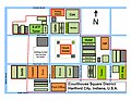 Hartford City Courthouse Square District 2010.jpg 2,200 × 1,700; 466 KB
-
 Hartford City Courthouse Square District 2010a.jpg 2,420 × 1,870; 325 KB
-
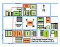 Hartford City Courthouse Square District 2010v2.jpg 2,420 × 1,870; 303 KB
-
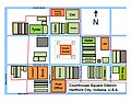 Hartford City Courthouse Square District.jpg 2,200 × 1,700; 454 KB
-
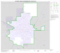
 Map of Hartford City IN 1876-2009.jpg 1,550 × 1,275; 136 KB
-
 Outline of Hartford City IN 1876-2009.jpg 1,375 × 1,300; 174 KB


