Category:Maps of Hawke's Bay
Subcategories
This category has only the following subcategory.
M
Media in category "Maps of Hawke's Bay"
The following 4 files are in this category, out of 4 total.
-
 General Electorates - Hawke's Bay Region.svg 550 × 644; 27 KB
-
 Hawke's Bay Population Density Map 2018 census.svg 626 × 750; 917 KB
-
 Hawke's Bay Region.svg 1,380 × 1,746; 537 KB
-
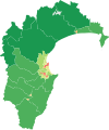
 Territorial Authorities - Hawkes Bay.svg 489 × 567; 33 KB


