Category:Maps of Hyderabad district, India
Subcategories
This category has only the following subcategory.
Media in category "Maps of Hyderabad district, India"
The following 6 files are in this category, out of 6 total.
-
 Hyderabad District 1951&1961.jpg 1,299 × 1,000; 572 KB
-
 Hyderabad district in Telangana.png 367 × 364; 53 KB
-
 Hyderabad District IN.jpg 2,158 × 2,260; 524 KB
-
 Hyderabad in Telangana (India)-2014.svg 1,024 × 742; 509 KB
-
 Hyderabad State 1901.jpg 1,512 × 1,034; 588 KB
-
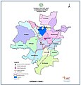
 Hyderabad-Dist-Mandals.Map.png 2,158 × 2,260; 1.47 MB


-2014.svg)

