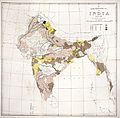
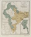
Category:Maps of India in the Wellcome Collection
Media in category "Maps of India in the Wellcome Collection"
The following 13 files are in this category, out of 13 total.
-
A map of India, showing Malabar, Madura and Cormeddel Wellcome L0038175.jpg 3,888 × 3,120; 3.34 MB
-
India; Map; 1929 Wellcome L0024831.jpg 1,482 × 1,322; 1.15 MB
-
Malarial map of India Wellcome L0069771.jpg 5,300 × 4,343; 4.48 MB
-
Map of India, showing the chinchona plantations Wellcome L0025460.jpg 1,282 × 1,437; 717 KB
-
Map of the Indian Empire. Wellcome M0001254.jpg 1,519 × 1,264; 746 KB
-
Map showing the distribution of Leprosy in India Wellcome L0039112.jpg 4,200 × 4,208; 11.9 MB
-
Map showing the distribution of Leprosy in India Wellcome L0039113.jpg 4,200 × 4,169; 11.75 MB
-
Map showing the distribution of Leprosy in India Wellcome L0039114.jpg 4,220 × 4,157; 13.09 MB
-
Map showing the distribution of Leprosy in India Wellcome L0039115.jpg 4,200 × 4,206; 10.6 MB
-
Map showing the route of cholera infection through Asia Wellcome L0074533.jpg 5,084 × 3,316; 4.45 MB
-
Salt and Leprosy - II. Wellcome L0038519.jpg 3,366 × 4,056; 3.06 MB
-
Sir Patrick Hehir, Malaria in India Wellcome L0026242.jpg 1,554 × 1,344; 764 KB
-
Weather chart of India Wellcome L0038517.jpg 3,924 × 3,978; 4.87 MB


